CANTERBURY
(stronghold of the Cantware, or people of Kent. The earlier British name for the settlement was Darovernon, meaning 'swamp fort'. The Romans adopted the name and called it Durovernum Cantiacorum.)
It's high time I covered what is undoubtedly the most important place in the history of the Church of England. Maidstone may be the County Town of Kent, but ask any stranger which is the most important, and the answer will be Canterbury.
Canterbury is such a complex city, with a history stretching right back to pre-Roman times, and historical buildings by the score, that this visit I could only cover a small portion of it. Romans, Catholics, Cathars, Huguenots, white friars, black friars, grey friars, Anglicans, have all left their mark on it, so it will take at least one more visit to cover it all.
I chose to not visit the Cathedral this time, as I really wanted to give an overview of the city this time round. However, if you would like a vision of how it looked in 1945, then ..................
The tomb of Edward, the Black Prince
Following his murderous death, the body of Thomas Becket was placed here, in the crypt. Almost immediately, there were reports emerging of miracle cures taking place there. Becket was declared a saint in 1173.
Canterbury was first a Roman city (Durovernum Cantiacorum), strategically placed on the Roman road (Watling Street, now called the A2) that led from the port of Dubris (Dover) to Londinium (London).
Later, it became a Saxon settlement, and then in 597AD, the site of the mission by St. Augustine to bring Christianity back to Britain. It was Augustine who founded the cathedral, as well as his now-ruined abbey, just across the road. This whole area, including the little church of St. Martin's (the oldest parish church in England still in use) has been designated a World Heritage Site.
Right so on to the colour stuff.............
Let's start with the city walls. Sadly, large portions of the city walls have gone, and only one of the main city gates still exists, even though the others exist in the names of the areas where they stood. (Northgate being the best known.)
This is the Westgate, with its enormous defensive towers. This stands where the main road from Dover exited the city towards London.
The above picture shows the famous inn that lies just outside the city walls - the Falstaff Inn. It was built in 1403 as a hostel for wayfarers. In 1783 it took the present name after Shakespeare's Sir John Falstaff.
Originally the inn was used by pilgrims who arrived at the city gates after curfew, when the city gates were closed for the night.
In the Second World War, the inn was hit by 26 incendiary bombs. Only one penetrated the roof, but found the iron-hard beams too tough to compete with, only a small amount of damage being done.
Almost everything of importance is contained within these walls. Outside stands the Abbey of St. Augustine's, two universities, the Kent County cricket ground at St. Lawrence, and a small suburb called Thanington Without - meaning Thanington outside the city walls.
You very quickly realise that the whole city is divided into areas names either for a religious order that had its' church there, or a saint who was relative to Canterbury.
Thus you have Greyfriars, Whitefriars, Blackfriars, St. Augustine's, St. Martin's, St. Gregory's, St. Dunstan's, St. George's, St. Peter's etc.
The Stour is divided into two arms which flow through the city. One arm flows outside the city wall, forming an extra defence, and the other flows right through the middle of the city
The main shopping area is not just the High Street, which is actually quite short, but St. Peter's Street and St. George's Street, which traverse from the Westgate Towers in a straight line across to where the Eastgate used to stand - now just a gap in the wall, as is the area of the Southgate. At Northgate, the wall has disappeared all together.
This is St. Peter's Church, which dates back to the 12th. century.
The Weavers house stands on the banks of the other arm of the Stour, and claims to date back to 1500. There was an influx of Flemish and Huguenot weavers who settled in the area after fleeing from religious persecution during the 16th and 17th centuries. Elizabeth I granted the Flemish weavers the right to establish their businesses in Canterbury, and they are known to have used this and other similar buildings nearby.
Despite the date 1500 which can be seen prominently displayed above the door, this house probably dates back to at least the 14th century. The current building largely dates to a reconstruction in the second half of the 16th century, not the first, as you might assume by the sign! Originally built as one house, it is now divided into three.
At the rear of the Old Weavers House is a medieval ducking stool, jutting out over the river. This ducking stool was historically used as a method of punishing 'scolds' - women accused by their husbands of talking back too much! The stool may also have been used as a more severe punishment for suspected witches. The suspected witch was dunked under the water and held there for several minutes. If she (it was usually a female) did not drown, she was proved a witch. If she drowned, at least her name was cleared!

The Eastbridge, or the Hospital of St. Thomas the Martyr, Eastbridge to give it its full name, is not a hospital as we use the word today. It was, and is still a hospital in the original sense of the word, a place of hospitality. In 1569 a school was established at the Hospital, and this continued for almost 300 years. Then in 1584, an act of Parliament changed St Thomas's remit completely; it was ordered to offer accommodation for 10 poor residents of Canterbury and to provide a dole payment to 10 more.
The Eastbridge Hospital still continues as an almshouse to this day and houses elderly people with a strong connection to Canterbury.
The Beaney Institute, or the Beaney House of Art and Knowledge, as it is now known, is the central museum, library and art gallery of the city of Canterbury. It is housed in a Grade II listed building. Until it closed for refurbishment in 2009, it was known as the Beaney Institute or the Royal Museum and Art Gallery.
Queen Elizabeth's Guest Chambers. All visitors to Canterbury should visit these historic rooms with their beautiful Renaissance ceilings. Open to the public for free. The ornamental plasterwork on the front of the building was done in 1698. The date of 1573 on the front of the building, refers to the time Queen Elizabeth I reputedly stayed here
You see people walking down the street here, busy looking at their mobile phones, and never looking above their heads at the wonderful details they are missing...............
The Buttermarket, and the City War Memorial.
This square is more than 800 years old. The name Buttermarket was first used about 200 years ago, previously the name was `Bullstake'. Bulls were tied and baited with dogs, both for fun and also because it was believed that it made the flesh more tender.
The Archbishop of Canterbury in 1921, who dedicated the War Memorial, was Randall Davidson.
There are so many listed 'Historic Buildings of Kent' in Canterbury. This is no.8 Palace Street, a 13th-century building with later additions. It may have been built as the rectory for the nearby church of St Alphege. The exterior is beautifully carved, with intricate floral and geometric designs rimming the jetties. The most intriguing features, however, are the carved brackets that support the jetties. These are in the shape of grinning demons, or grotesques, holding their bulging breasts in a pretty suggestive manner. Though one may be a female figure, the other is most definitely male
The Sun Hotel, formerly, in Dickens' time, the Little Inn. It was built in 1503 and stood empty for 40 years until Debenhams restored it.
Conquest House. On 29 December 1170 four knights, Reginald FitzUrse, Hugh de Moreville, William de Tracy, and Richard le Breton, met at a house near Canterbury Cathedral to plan what they would do on the morrow. Whatever plan they discussed, the result was the murder of Thomas Becket, Archbishop of Canterbury, a deed which changed the course of history and certainly changed the fortunes of Canterbury itself. The place where the knights met is reputed to be Conquest House on Palace Street.
At that time Conquest House was owned by a man called Gilbert the Citizen. The knights initially left their servants and weapons in Conquest House while two of their number entered Bishop's Palace by force and remonstrated with Becket, trying to get him to remove the excommunication he had placed over several of the king's supporters.
It was a lost cause from the start; Becket was too strong-willed to succumb to their threats. The knights returned to Conquest House and gathered their weapons. In the meantime, the archbishop's servants convinced him to retire to the cathedral. It was no use; the knights entered the cathedral, and after a further argument, killed Becket in the area now called The Martyrdom.

Part of the King's School. King's is a public school (English independent day and boarding school for 13 to 18 year old pupils)It is a member of the Headmasters' and Headmistresses' Conference and the Eton Group. It is Britain's oldest public school; and is arguably the oldest continuously operating school in the world, since education on the Abbey and Cathedral grounds has been uninterrupted since AD 597. Among the famous students who have attended King's School over the years are William Harvey, W. Somerset Maugham, Hugh Walpole, Christopher Marlowe, and John Tradescant.
Sir John Boys House (sometimes known as the Crooked House, King's Gallery, or Old Kings Shop) is a delightfully skewed 17th-century half-timbered building at the extreme end of Palace Street, with projecting jetties onto Palace and King Streets.
The house is named in memory of Sir John Boys, an MP and the first recorder of Canterbury (d. 1612). The most noticeable feature is the front door, which has had to be built with severely skewed corners to fit the door frame.
The house reputedly gained its markedly skewed look after alterations to an internal chimney caused the structure to slip sideways. Attempts to rectify the slippage actually caused the whole structure to skew further sideways, though now the building is stabilised internally by a steel frame
The Bell And Crown, opposite King's in Palace Street has apparent scant regard for the staff of King's!
Henry III granted the Black Friars land on an island in the River Stour. Here they built their new friary. There are only two buildings of the friary remaining; the guest hall and the former rectory, this, which is now used by Kings College art centre.
So, now back to the Friars area of the city. This is where the river passes down the side of the Marlowe theatre, and forms part of the Canterbury Sculpture Trail.
Blackfriars consists of the remains of a 13th-century friary on the banks of the River Stour. Blackfriars was founded around 1237 by Dominican monks, whose black surcoat gave them the popular monicker 'Black Friars'. Henry III granted the Black Friars land on an island in the River Stour. Here they built their new friary. There are only two buildings of the friary remaining; the guest hall (this building) and the former rectory, which is now used by Kings College art centre, features elsewhere in this article.
Picture taken from the bridge between the Marlowe and the Friends' Meeting House (Quakers). The minaret-looking tower in the centre of the picture, is called the Alchemist's Tower. You can only get to the outside of it by boat, but the interior can be reached from an old shop in Best Lane.
Although 'improved' by the Victorians, it actually stands on a Roman site, and has medieval foundations.
It is actually a chimney, and inside you can still see the hearth.
The Cathedral towers above the city, and the City Council has wisely not permitted any high-rise buildings to obscure it.
This is a statue of lovely Dave Lee, a long time starring dame in pantomimes at the Marlowe. He sadly died at the young age of 64, having made over two million pounds to give disadvantaged children in Kent and their families a holiday. He was awarded the Freedom Of The City posthumously, so if you see his ghost wandering the streets, have a laugh with him! He'd enjoy that!
This is the Bulkhead statue by Rick Kirby
The Marlowe theatre. It's not a very big auditorium, and some areas have viewing issues, but the acoustics are good. We go every year to the concert by Jools Holland's R&B Orchestra, and delight in the amazing Ruby Turner as she rocks the roof off!
The statue to Christopher Marlowe. Christopher Marlowe, also known as Kit Marlowe, was an English playwright, poet and translator of the Elizabethan era. Marlowe is among the most famous of the Elizabethan playwrights being Shakespeare’s most important predecessor in English drama, who is noted especially for his establishment of dramatic blank verse.
In 1593 Marlowe was killed by Ingram Frizer, in the dubious company of Nicholas Skeres and Robert Poley, at a lodging house in Deptford, where they had spent most of the day and where, it was alleged, a fight broke out between them over the bill.
The Sidney Cooper Gallery. What's it famous for?
Well, see this plaque; and if, like me, you grew up when Rupert was more famous than Paddington, you'll be thankful for the Sidney Cooper Gallery!
The Masonic Temple - just a very ordinary building
just random views................
Geoffrey Chaucer - of course, best known for The Canterbury Tales, a bawdy collection of stories told by a group of pilgrims on their way to Canterbury.
On the base, is a list of the actors who appeared in the film of the 'Tales' The 9th. one down is a local boy made good!

These two road signs go back to when the A2 road from Dover to London ran right through the middle of the city. Somehow they got overlooked and never removed. They're now a permanent part of the city history
Another war memorial - this one is specifically for the men of the Royal East Kent Yeomanry
Mercery Lane, which would normally give an impressive view of Christ Church Gate, the main entrance to the cathedral precincts. However. that's being refurbished at the moment. It is a rather nice sheet though!
This was formally St. Margaret's Church for the Deaf. Now it houses the Canterbury Tales Experience. All vey bawdy and naughty, but you do it with headphones on, and they have a dumbed down version for kids
Butchery Lane, where the name speaks for itself.
He's watching you...........................
This lamp hangs in the middle of Mercery Lane
Right, now to my favourite part of the City - the wonderfully peaceful Greyfriars. All that's left of the priory is the small chapel spanning the river. The rest has been turned into an amazing medieval garden, which features fruits such as quince and medlar, vegetables, and medicinal herbs. The lady gardener that was there today, was only too pleased to chat and discuss the plants. It's an area of medieval history I'm really keen on.
St. Francis of Assisi - who was not the founder of the Franciscan order. The founder was one Francesco Bernadone, the son of a wealthy cloth merchant. Greyfriars in Canterbury was the first Franciscan house in England, founded in 1224.


Greyfriars Chapel is the only remaining part of a Franciscan friary established in 1267. Greyfriars (named for the grey habits of the Franciscan order of monks) was the first Franciscan monastery in England. The friary was established on an island site granted by the master of Poor Priest's Hospital. In 1263 a further grant of land on the far bank of the river allowed the friary to expand, and it eventually grew to take in 18 acres.
It is not clear what the original function of the two-story chapel building was; it may have been an infirmary or residence, but despite the name it was almost certainly not a chapel. It has, however, become a consecrated building and now hosts regular services. In 2003, fully 465 years after they left, Franciscan brothers returned to Canterbury, and today they live in nearby cottages and work in the city centre parish and Eastbridge Hospital, and worship in this old chapel building.


When I lived in Canterbury, all those years ago, Greyfriars was accessed by a path that ran through the Postal Sorting Office, and it was free to all. Sadly, it was much abused and the little chapel suffered severe vandalism.
You now have to access it from a little shop in St. Peter's Street, and access will cost you £6. You do get a nice little visitor guide, and the money goes to the upkeep and regular patrols by a security firm. £6 is really not a lot to pay to ensure that the work they are doing will preserve some important historical knowledge
The Visitor guide is a mine of information - way too much to repeat here. Go to Canterbury, pay your £6, and get a copy for yourself!
Back to St. Peter's, and high up on one corner is a plaque marking the site of the long-gone Black Friar's Gate, which presumably was the entrance to the Blackfriars priory
CHARING
My husband's mother came from a Charing family, that also had connections to other Kentish villages and towns. So there will be the odd mention of them where relevant.
The earliest archaeological
evidence of human habitation in the parish comes
from a recently discovered early Roman cemetery,
which contains high-class burial goods; there is also
evidence for Roman buildings in the vicinity.
Charing was given to the Church of Canterbury by
Egbert II, King of Kent between 765-780, and the
manor remained the property of the archbishops
until Henry VIII took it from Archbishop Cranmer in
1545.
Lying as it does, just below the Pilgrim's Way route to Canterbury Cathedral, and connected to the main road from Folkestone to London, it seemed a logical place for the Archbishops of Canterbury to build residence. And so they did - next door to the church stands the remains of the the manor house, known as the Archbishop's Palace.
In the Middle
Ages, a road from London to Canterbury and the
coast, passed through the village. A market
grew up outside the manor gates, and the present
settlement was largely in place by the fifteenth
century.
In the eighteenth century some elegant houses were
built. Small
alehouses gave way to large coaching inns, but
these declined in importance with the coming of the
railway in 1884.
So, we'll start with the actual village. The main A20 from Ashford to Maidstone, effectively cuts the village in half, but nearly all the important buildings lay on the same side of the church, which makes exploration easy. As I parked in the Market Place, outside the church, I'll start there.
No 4 The Market Place was the old Poor
House, and has a small window (outlined in white)
through which alms were given to poor travellers.
The garage to the east once housed the manual fire
engine.


Elizabethan Court
Formerly the Swan
Inn, contains a
medieval timber
building, enlarged in
brick in the 17th
century and later. It was probably an inn from the 13th
century when we know the archbishops owned an
inn in the village. The name, 'The Swan', is an early
one. The large iron bracket carried the sign
Wakeley House
was built by Edward
Wakeley in 1718. It is one
of a number of elegant
dwellings of this period in
the High Street, and has
finely decorated window
heads.
No 61 (Venture Works) This is opposite
Old School House, and was a corn chandlers. The
Cackett family, who lived there early in the 20th
century, had first a bicycle and then an early motor
car business. They were credited with building a
motorbike named the 'Invicta'. Note the early petrol
pump.
That's the house on the right, and Alfred's workshop on the left. The house is now called Venture House. And here comes the family connection......My husband's aunt (mother's sister), was married to oine of Alfred Cackett's sons.
Ludwell House dates to the early 18th
century. A monument to Elizabeth Ludwell, who died
in 1765, is in the church. She was a generous
benefactor to Charing, providing money for a
schoolmaster; a trust fund still provides for students.
The 'Wady & Brett' Shop is a medieval
building. It originally faced School Road, which was
the main early medieval through-road from
Maidstone to Ashford past the church. The road was
later moved north and then south of the village, until
the A20 was created in 1928 cutting through the
lower part of the village.
Peirce House
has a well documented
history. In the Middle
Ages the house was at
least twice its present
size, but half the open
hall and the entire
parlour end were
demolished. In the early
16th century the Brent
family added the fine
porch and doorway.
Margaret Brent married
George Nevill (Lord
Abergavenny) around
1501, and the spandrels over the porch doorway
contain the arms of the Brents (left), and the crossed
staples badge of the Nevills (right)
Attached to Peirce House, is Peirce cottage (above), of a later date. Peirce House has been divided into two cottages.
Over the
door are the arms of the Brents and Nevilles, celebrating the 1501 marriage of
Margaret Brent to George Neville, Lord Abergavenny.
Nos 27 & 29 were built in the early 16th
century as a row of shop units. Note the unusual
survival of the original shop windows and doorway
behind the name board 'Sherbourne House'.
Upstairs there may have been workshops, probably
used by leather workers or weavers. In the 17th
century the north end became a dwelling.
Ah, a quick delve into the mysterious interweb, revealed that this is a Grade II listed 18th. Century coaching inn with 20th. century 'amendments'. It was formerly the King's Head Public House
These two plaques are either side of the door in the building above. Lovely building - deserves some history
So there's just this one then....................
Ok, so now I'll walk back down Market Place towards the church (mind the guy chopping dead branches off the conker tree!) and take a look at what's left of the Archbishop's Palace and what else surrounds the church.
The history
of the palace goes back to the 8th century. In AD 788 Kenulph of Kent granted
land at Charing to Christchurch Priory at Canterbury to build a residence. The
residence evolved over the centuries into a complex of buildings based around a
hall.
The remaining buildings of the palace have been converted into dwellings, so the courtyard is a no-go area. Best you can do is stand in the gateway and take a quick peek. There are some cottages built into the wall alone the edge of the market place, and you can get a quick glimpse of the Big Barn and the roofs of other houses over the high wall which runs along the churchyard. There's also a couple of younger buildings at the back of the church.
Because I can't get a proper look at anything, I've just put all the pictures here.
The private
apartments of the archbishop face the main gates which give onto the former
market place. By tradition whenever an Archbishop of Canterbury visits Charing
he enrobes at the Palace (by permission of the current owner) before walking to
the neighbouring parish church.
The
very large great hall of the palace is now a barn, the top of which can be seen
from the churchyard.
It is
thought that both Henry VII and Henry VIII stayed at the palace on numerous
occasions. In 1520 the Palace hosted some of the 4000 men and women of Henry
VIII's entourage as they journeyed to the king's famous meeting with Francis I
of France at the Field of the Cloth of Gold near Calais.
The Charing
estate remained in the hands of Canterbury Priory until 1545 when Archbishop
Cranmer exchanged it with Henry VIII. The crown rented out the manor house,
which became a farmhouse.
In 1559
Archbishop Parker tried to reassert church control over the palace and become
both tenant and farmer of the Charing estate but the palace was instead sold to
Sir Richard Sackville. It has been in private hands ever since.
Tucked
behind the church on Vicarage Close are two historic buildings, the oldest
dating to the 14th century and thought to be the oldest building in Charing.
The second building, the current vicarage, dates to the 15th century and was
originally the church hall before being converted into a dwelling.
Opposite the palace, is the village recreation ground, and a pretty memorial garden to Charing's own V.C., Corporal Frederick George Coppins.
There are two unusual itams embedded in the paving of the garden. One is a replica of his Victoria Cross....

The other is an unusual, huge, horizontal sundial. Can't work out how it works, but nevermind - it's quite a feature.
And so to the church..............
The church of Ss. Peter & Paul is a handsome building, with lots of interesting things inside. In 1590 a
fire destroyed the roof and a large portion of the interior. According to
reports at the time, the fire was started when someone fired a gun at a pigeon
on the roof of the church, which caused the roof timbers to catch fire.
(above) the very elegant clock, and below, the West entrance, which is closed, but a sweet little arrow directs you arounf the corner to the south porch.
A long nave. but the clerar windows make it very light. There are few plaques in the nave, but the Royal Tank Regiment memorial plaque caught my eye.
Every pew has a long tapestry cushion runner. They're all different, and have either scenes from the Bible, or local references
In the late
15th century the Lady Chapel was built on the south side of the chancel by Hugh
and Amy Brent, replacing an earlier chapel. It became known, not surprisingly,
as the Brent Chantry, though it later passed to the Deering family.
The altar is surrounded by tomb slabs to members of the Dering family. The Derings have been Lords of the manor of nearby Pluckley for years. Most of the ledger slabs are unreadable, however, this one caught my eye. It is to the memory of Catherine, wife of the Reverend Edward Dering, and daughter of William Levet Esq., who attended King Charles I on the scaffold of his execution.
The Archbiishop's throne, for when he is in attendance. He still has the right to enrobe at the palace, before walking across the courtyard to the church.
St. Edmund's side chapel is dedicated to St.Richard of Chichester (1197 – 3 April 1253), who was once rector of this church, and who is patron saint of Sussex.
The parish chest. It would have had 3 locks, witrh the vicar and two vergers holding a key each, to prevent theft or fraud.
The Charing Clock. Unfortunately, it was placed in a very dark corner under the tower, and I couldn't get a good view of the description. I'll find out about it and update later.
This is by no means the end of exploring Charing. I will have a very sad tale to relate at a later date, regarding a close member of my husband's family, the parish church, and the village lake. But I don't have ther
necessary pictures yet, so that will have to wait.
CHARTHAM
Chartham is currently making a bit of a name for itself by producing wines. However, until recently, it was better known for having the largest paper mill in Europe. The Mill probably started life by grinding corn, and later it became a fulling mill for woven cloth. By 1730, it had become a paper mill, and remained so until its' closure. It changed hands several times, but in 1939 became noted for its tracing paper. It produced all the tracing paper the War Department needed, for it is a necessary tool for designers of everything, from tanks to radar. Now it is derelict.
The other thing Chartham became noted for, was the Lunatic Asylum, which later became St. Augustine's Mental Hospital. That too has closed, but the buildings have been converted for residential use.
I couldn't visit either of these today, as Ratlington Street, which leads there, was closed. They're on my list for a later visit though, as they are really the reason for the village existence.
So today, I had to be content with the church.

I parked opposite the church and wandered in. Immediately, I was greeted by a little curly ginger thing that bore more resemblance to a teddy bear than a dog, and which was obviously very pleased to see me. Me: getting down to cuddle him "Hello poppet, who are you then?"
Disembodied voice: "Hello, I'm the new vicar of St. Mary's"
Me: "I kinda guessed that from your pretty blue dog collar"
Disembodied voice: silence, followed shortly after by a huge eruption of laughter, when he realised I was still talking to the dog 
The new Vicar emerged from behind a pillar, and introduced me to Benji, who promptly demanded to go for a walk.
The church is light and airy, and has a pleasant atmosphere. It also has a very odd modern wooden screen at the West end of the nave. Even the new vicar is a bit perplexed as to why, and of what use it is.
There are a few memorials, the most famous of which is the brass to Sir Robert de Septvans (d. 1306), one of the oldest and largest memorial brasses in the country, showing the cross-legged knight with flowing locks. The crossed legs usually denote that the knight was a crusader.
There is a board explaining what is known of Sir Robert.
The brass itself has been rescued from the floor to protect it, and there is also a full-size reproduction of it so that you can see the details clearly.
There is also a colour representation of him, painted on a glass panel. A matching glass panel shows characters from Chaucer's 'Canterbury Tales'
So what do we know of Robert de Septvans? There is a lot of confusion over which Robert is which. By tradition, the first-born son carried the name. This one, however, was born c1250.
He probably took part in the 9th. Crusade, under Prince Edward, who later became Edward I, and who later endowed Chartham church.
The name Septvans probably derives from 'Septem Vannis' (seven winnowing fans used to separate the wheat from chaff in the threshing process), a distinctive design which appears to have been the emblem of his family and which also appears on the commemorative brass. The de Septvans' family motto 'Dissipabo inimicos Regis mei ut paleam'. 'The enemies of my King will I disperse like chaff' suggests a connection between the family emblem and the sentiment of their motto.
In 1275 Sir Robert was made Constable of Rochester Castle. Rochester Castle was strategically important as it dominated the Medway estuary and was regarded as an essential part of the defence of South East England. However, this would also have been at a period of managing decline at the castle as, due to the effects of a siege in 1264, much of the castle was burnt out ruins. It had also suffered from many years of pilfering of materials from what remained. As a Knight for the Shire of Kent, Sir Robert's association with the monarch continued. In 1300 he fought with King Edward I at the battle Caerlaverock, on the southern coast of Scotland, and continued northwards with the King's army to fight against the Scots led by William Wallace. At the siege of Caerlaverock Castle he was created a knight banneret by the King for gallantry. In medieval
times this was an honour bestowed by the monarch and meant that a knight could bring a company of his own followers into the field of battle under his own banner. Under English custom the rank of knight banneret could only be conferred by the King on the field of battle. The military rank of knight banneret was higher than that of knight bachelor (who fought under another's banner), but lower than that of an earl or a duke.
In 1304, with his increasing infirmity, he was relieved of this role and eventually died in 1306. He was buried in St Mary's at Chartham, probably close to the altar as befitted his rank and achievements. And so St Mary's Church at Chartham became the final resting place for Sir Robert de Septvans, a 13th Century Medieval Knight.
This church has plenty of explanatory boards like this.
Brass memorial to Lt. Col. Charles Peter Marten, who was killed in action on the Somme, aged 36. He was the son of Capt. S.W. Marten of the East Kent Militia, who lived at Shalmsford Bridge Manor, just down the road from Chartham. He was buried in Serre Cemetery, France.
Tomb of Sir William Young, Baronet, and his first wife, Sarah. Another verbose tribute. Young was born in Antigua, and went on to become Governor of Dominica.
I kept coming across references to the Fagg family of Mystole. I had never heard of Mystole before this. It seems to be a small collection of buildings just outside Chartham - too small to be even called a hamlet. Further investigation is needed. I am assuming there was once a larger house there. All I have found so far, is that he married Elizabeth Le Grand
DYMCHURCH
Dymchurch is a wonderful village for families with small people. Margate may have Dreamland, but Dymchurch has its' equivalent aimed very much at children. Add to that a station on the Romney Hythe and Dymchurch Railway, and the only sandy stretch of beach between Folkestone and Camber, and you have the perfect recipe for a family holiday.
The beach has a ridge that is crossed by the sea at high tide. Then when the tide goes out, it leaves a shallow lagoon behind. On a hot day, the water here heats up nicely, and it is a smashing place for little toddlers to paddle safely.
This is the church of St. Peter & St. Paul.
These two modern stained glass windows are one each side of the porch and decorated with flowers, give you the feeling that you are entering somewhere special.
Oh look - another mosaic - with the funfair, the church, the donkeys and sand, lots of sand.
This is another modern stained window. This one is a memorial to Tom Miller, who was church warden here for 20 years.
This archway shows the church's Norman roots.
A plaque to Russell Thorndike, who created Dr. Syn, the one-time Rector of the church, and part-time smuggler. The books are real adventures and sometimes quite cruel. They have spawned an entire industry around the central character, including the bi-annual 3-day 'Day Of Syn' festival. Even the light railway has a loco named for him.
Russell Thorndike, brother to actress Dame Sybil Thorndike, was an accomplished actor himself. But writing was always his first love. He was born in Rochester, but is buried here, in the place that meant so much to him.
This strange post once supported a sundial, which has been relocated to inside the church!
Dymchurch has three remaining Martello Towers out of an original six, within its' bounds. The one on the Hythe side has been converted into a residence. The one on the New Romney end of the village, number 23 (below), stands in the public car park, and is currently having work done on it - not sure what it is going to be yet..........
The third one stands in the middle of the village, close to the funfair, and houses a museum. It took half a million bricks to build the tower, which is number 24 of an original 79 towers stretching along the coast of Kent into Sussex. It has now been restored to its original condition.
EASTRY
(easterly district. Once a region of Kent in Jutish times, the name now only exists in the village)
When I was a teenager, we used to meet up with friends at a little cafe in Eastry. Well, that is now a house, so I've never had a reason to go back there.
I wanted to see something specific in the church, but I couldn't find it. However, the church is very pleasant and proves that the village was once a prosperous place. Indeed, it was once a Saxon royal capital.
Here the Saxon kings had a Royal Hall on the site north of the Church, now occupied by Eastry Court, which was reputedly the scene of the murder in 665 of the two young princes, Etheldred and Ethelbert. Two Saxon burial sites in the village date from this period.
On the south side of the Church lies the former Tithe Barn (rebuilt 1832), now Aumbry Cottages, and the Parsonage Farm now known as the Aumbry (rebuilt 1825) from its having belonged to the Almonry of the Prior and Convent at Canterbury from the 12th Century.
The village was the birthplace of Henry of Eastry, Prior of Christ Church, Canterbury 1285-1331 in whose honour the Cathedral tower bears the name Bell Harry.
In Lower Street on the west side is Fairfield a 15th century aisled hall house, and in Mill Lane, the former Union Workhouse (1835) which became Eastry Hospital and which is now closed.
Beneath the garden of Beckets on the west side of Woodnesborough Lane are the Caves (now closed), a long series of galleries excavated in the last century by the Foord family in the course of extracting chalk for lime burning.
The Old Vicarage in Church Street was in use as the Vicarage until 1980 and stands on a site appropriated to that purpose in 1367.
In the 19th century the village possessed four windmills, only one of which now remains, as a private residence.
In 979 AD King Ethelred made over the Palace and Manor in Eastry to Archbishop Dunstan and the Priory of Christ Church Canterbury. The Normans built a new church in the late 11th - early 12th century, and in the early 13th century the church was lavishly rebuilt in the early English style of architecture by the monks of Christ Church Abbey, Canterbury.
The Norman church almost certainly replaced a Saxon building, since Eastry boasted a Royal Palace for the Kings of Kent as early as 660 AD. The origins of Christian worship on this site are lost in antiquity.
Amidst all the legends, history and rumours, I need to return when I have more time to explore the rest of Eastry.
Meanwhile, today was just a quick visit to the church of St. Mary the Virgin.
Opposite the church entrance, is a small park, and I found these tiny cyclamens growing amidst all the fallen leaves:

On the west wall is a good early 19th century Royal Arms with hatchments on either side. It was the gift of Thomas Moulder of Statenborough House, Eastry in 1821.
The east nave wall has a pair of quatrefoils pierced through into the chancel. However this feature pales into insignificance when one sees what stands between them - a square panel containing 35 round paintings in medallions. There are four designs including the Lily for Our Lady; a dove; Lion; Griffin. They would have formed a backdrop to the Rood which would have been supported on a beam the corbels of which survive below the paintings.
This commemorates John Harvey who died in 1794. It shows his ship the Brunswick fighting with all guns blazing with the French ship the Vengeur. John Bacon the Elder carved this detailed piece of work.
The gentleman below was taken from a brass rubbing and reproduced in all it's glory in glittery colour
FORDWICH
The pretty, unspoilt place that is Fordwich, is actually Britain's smallest town - complete with the cutest town hall! Its right to style itself a town dates from 1184, when King Henry II granted it a Merchant Gild Charter, reflecting its importance as the de facto port for Canterbury.
The original Fordwich corporation, with its liberty and privileges, was abolished in the local government reorganisation of 1886, and Fordwich Town Council today is, in legal terms, a parish council.
However, the chairman of the Council is styled the Mayor, and on ceremonial occasions wears a chain of office as well as other mayoral accoutrements. By custom the Mayor also serves as Mayor Deputy to the Mayor of Sandwich, thus preserving the historic Cinque Ports link.
The Town Hall, built in 1544, stands on the river bank, opposite the Fordwich Arms pub/hotel, in the centre of the tiny town. It is still used for civic meetings, but it also functions as a local museum. It was closed when I was there, but I will return, because, apparently, it has a ducking stool, similar to the one at Canterbury.
The wall alongside the Fordwich Arms is where the Roman quayside was. It was still active, after the Norman invasion as the stone for Canterbury Cathedral was unloaded there, having been quarried in Caen, Normandy. It was then transported on carts to the city.
In the 13th. Century, it became involved with the Cinque Ports, through its' navigable connection to Sandwich. This is the reason why, in the church, there is a wall plaque featuring the Cinque Port Arms, and a wonderful wooden ship!
Apparently, Izaak Walton fished for trout here.
Before we get to the church (conveniently situated behind the Fordwich Arms), let's take a stroll round the town. No modern edifices here! A large portion of the buildings date back to medieval times. Others are positively modern - well, Georgian
This one is the Manor House. It was home to Alfred Palmer (see info in the church section)
'Give Ale Cottage' is a Grade II listed building. So far, I haven't been able to establish the reason behind the name.
Apparently, there are two blue plaques in Fordwich. I missed one, but found the other. Sometime when I'm passing, I'll have a look and try to find the other one. Apparently, I walked along one side of a corner house, and the plaque is round the corner!
But, here is the one I did find:
Brothers John and Gregory Blaxland were pioneer settlers and explorers in Australia. They were the sons of a Fordwich gentleman farmer, and were educated at King's School in Canteerbury.
In 1805 John and his younger brother Gregory were persuaded by Joseph Banks to emigrate to Australia. Blaxland made a good bargain with the English government which agreed that if he brought £6000 to the colony he would be granted 8,000 acres (32 km2) of land, the labour of 80 convicts who would be fed for 18 months by the government, and a free passage for himself, his wife, children and servants.
The story of how they fared in Australia, is far too complex to put here, but it is well worth looking up.
The fact that they were freemen, and not emancipated convicts, gave them a definite advantage down under, and as a pioneer grazier became an important figure as the quintessential 19th century enlightened English gentleman in the early development of Australia.
And so to St. Mary's church.......
Firstly, Over the door of the tower arch is a set of bread shelves. These were used to store bread to be given to the poor every week, according to the terms of a bequest from Thomas Bigg, who died in 1669. Unfortunately, I wasn't able to take a picture here
This is known as the Fordwich Stone. It is a very narrow rectangular block of limestone, 1.7 metres high (about 5.5 feet), covered in exquisite carvings.
The stone has traditionally been considered to be part of St Augustine's tomb. He was buried at St Augustine's Abbey at Canterbury, from whence the stone is alleged to have come.
A tomb-shaped stone like this would have been placed over the relics of an important figure such as a saint, so it is always possible that the Fordwich Stone was actually used to denote the final resting place of Augustine.
No one knows when the stone first came to Fordwich. It is known that it was removed to Canterbury Cathedral after 1760, and then returned to Fordwich in 1877. It is, without doubt, part of a shrine, but was it the shrine of St Augustine? There is nothing to base the tradition on except for the excellent quality of workmanship. It is a magnificent piece of medieval carving, and the carving can be stylistically dated to the 12th century.
I somehow missed the blue plaque to Alfred Palmer in the town, but I'll try to make up for it here.
Alfred was a painter in oil and watercolour, sculptor and draughtsman, landscapes, portraits and figure subjects. He studied art at the Royal Academy, where he came under the influence of John Singer Sargent, and at the Académie Julian, for several years around the turn of the century. He maintained a studio in Paris and travelled regularly to Italy, Germany and Spain. He had a fine bass singing voice, which was trained while living in Florence. In 1906 married the artist Mary Croom, with whom he settled in Fordwich. Palmer continued his travels in North Africa, and his ability as a linguist led to his doing secret service work in World War I.
Not familiar with his work? O.K. Neither was I - but I am a huge fan of his mentor, John Singer Sargent.
This alms box in the central aisle is inscribed 1953 and ER, to commemorate the coronation.
The tympanum above the chancel arch is painted with a royal coat of arms of 1688, and the text of the Ten Commandments. These are Royal Arms of James ll. He was the last catholic monarch of England. He was deposed by the protestant William III in the ‘Glorious Revolution’, and the latter’s royal cypher, WR has been added at the top of the Arms of James II.
The interior of St Mary is filled with attractive box pews, most of which can be dated on stylistic terms to the 18th century. The easternmost pew on the north side of the nave belongs to the Corporation (the town government). There is a wrought iron holder for the corporation's gilded mace, which is displayed each year on Mayor's Sunday.
Tapestry of the Last Supper
There are several interesting memorial brasses about the church, including an effigy of Aphra Hawkins, who died in 1605. Her effigy shows her clad in lovely period costume, standing on a pedestal beneath her coat of arms. Sadly, it is quite badly worn. Aphra died in 1605, aged 21. She was the wife of Henry Hawkins, and daughter of Thomas Norton,
In May 1883, the Kentish Gazette carried a curious news item:
'Now that the Rev. E. Brailsford, having been released from prison, has resumed his duties at Fordwich Parish Church. The good that has been done in his absence is melting away. He has dismissed the choir, so carefully got together by the Rev. Stuart Robson, and has in other matters so thoroughly gone back to the 'Old Lines', that whereas, during his absence, the church has been crowded, the congregation has now fallen back to the half-dozen old women looking out for the charities'.
The Revd Edward Brailsford, was
Rector for 41 years. He
was an extreme Protestant who, in 1873, wrote and published an open
letter to the then Archbishop of Canterbury, entitled Incipient Idolatry in
the Church of England, berating the vicar of Sturry for having a reredos
erected in his church, with the ‘highly objectionable representation’ of
Jesus on the cross, and his Mother and St John nearby. He was the first
incumbent for many years to reside in the parish, although he did spend
periods of time living elsewhere.
And that, folks, is all I've found out about him so far.............
GARLINGE
I've not yet come across much of interest to me here - that is, except for this curious old gatehouse. It's well hidden, and a private residence, hence the only pictures had to be taken from the road-side. I would really love to be able to have a good look round it. It's called Dent-de-Lion (dandelion or lion's tooth).
The gatehouse dates back to the early 15th. century, and is Grade II* listed. The property is a private residence, so I can't get any closer - worst luck! It's the only remaining structure of a medieval fortified house, long since demolished, and the space it occupied now covered by housing.
Each tower contains a newel staircase giving access to the roof.There's a carved stone shield over the carriage arch, representing the coat of arms of the Daundelyon family, for whom the gatehouse was built.
The builder of the fortification was John Dent De Lion (Daundelyon). He fortified his manor because of the threat of a Flemish invasion after 1435, which encouraged a new wave of fortifications on the south east coast.
It is recorded that the site was later used for more disreputable purposes as a base for Dent De Lion’s smuggling activities. In the 18th century the estate and castle was sold to Henry Fox, Lord Holland, and passed to his son Charles Fox.
GODMERSHAM
The parish of Godmersham covers a large area, but in essence, is no more than a few scattered dwellings either side of the main A28 Ashford-Canterbury road
And then there's Godmersham Park........................
That's where my focus is. The village has very little to recommend it, being very much integrated with Crundale these days. Indeed, the church is now part of a benefice of 5 churches, with a vicar who is resident elsewhere.
There is the Old Post Office at the crossroads, but that's about it. Even the nearest pub is in Crundale.
Godmersham Park house is now a college. owned by ABDO, the Association of British Dispensing Opticians, and the gardens are only open to the public once or twice a year. The house is closed to the public at all times. The house and gardens are surrounded by a high brick wall, so you can't even see it, except from one of the footpaths that passes behind the house.
This lovely Georgian manor house on the northern edge of the village was built in 1732. Its most famous resident was Edward Knight, brother of novelist Jane Austen. At the age of 18, Edward was adopted by Thomas and Catherine Knight of Godmersham. The childless couple sent Edward on a Grand Tour of the Continent, and when Thomas died in 1794 he left Godmersham to Catherine for her lifetime and then to Edward. She decided to move to Canterbury and gave Godmersham House to Edward.
Jane Austen visited her brother at Godmersham several times and used the library there to research her novels. She used the house as the setting for parts of her novel Mansfield Park and describes the architecture of the house exactly as we see it today.
However, the extensive parkland surrounding it, is open for you to freely wander through. But be advised, it is a working estate, and there is livestock, so please keep dogs, lions, giraffes, etc. on leads!
If you enter the estate from Godmersham crossroads, the first building you see is this charming house, and a hexagonal dovecote.
Move along the lane, and high on the hill, behind the dovecote, is this charming Greek Temple folly
Further along the road, a pretty bridge crosses the River Stour, on its' way to Canterbury
You then immediately come upon the gatehouse, and the elegant wrought-iron gates
From here, the road gently curves to the left, away from the wall of the house. There's a smattering of buildings opposite the wall, mostly providing accommodation for the college students. One of these is the Old Vicarage. There is no 'new' vicarage, as there is no longer a resident vicar.
Continuing along the road, you will first come to the Godmersham Park Heritage Centre, with an exhibition on the history of Godmersham and Crundale, and on the estate itself. Among historic items of interest is the diary of Jane Austen's niece, Fanny Knight, and a copy of William Harvey's ground-breaking book on the circulation of blood. Unfortunately, it is only open on a Monday afternoon, so I haven't managed to get there yet.
But the next building is St Lawrence the Martyr church which dates to the 11th century. Absolutely loved this one. It has a friendly, warm atmosphere, and is light and airy.
Walking around the outside of a church before entering, is something I always do. In this case, it clearly showed the church's Norman roots.
There is also a beautiful view out over the peaceful countryside
There is also a corner of the graveyard where all the graves and memorials are for one family.........the Hollands. The main slab is the grave of Francis James Holland, long time canon of Canterbury Cathedral.
And so to the interior.
The first thing that grabs your attention are the pew-end candle holders.
The little splashes of colour really lift the interior.
In the chancel is a 12th-century bas-relief thought to depict Thomas Becket - although it could be Archbishop Theobald (d.1162) Most consider it to be one of the earliest likenesses of Becket, which may have formed part of a tomb in Canterbury Cathedral.
The small organ is beautifully decorated.
The angular font is made of polished Devonshire marble, which appears to be similar to our local Bethersden marble, in that it is full of tiny fossils.
Early in the twelfth century a northern tower with small apsidal chapel was added to the north of the nave. This has recently been restored and its round headed windows may be clearly seen. It is not in general use, but the lady doing the altar flowers let me in to have a look.
The apsidal ceiling is echoed by the pattern of the glass in the two little windows. It's most enchanting.
The memorial plaque to Edward Knight - Jane Austin's brother - and his wife, Elizabeth.
The beautiful illuminated memorial on the north wall is to 'Susanna Sackree' the family nurse and Jane's friend.
GREAT CHART
Great Chart is first mentioned in 762 as Seleberhtes Cert, a Jutish name. It is also known that at this year, the village was operating a mechanical water mill, the first water mill to be recorded in Britain. A charter first mentions Seleberhtes Cert when recording that King Ethelberht II (of Kent) exchanged half the use of the successfully operating mill for some pasture in the Weald.
In 776 Great Chart's manor, the village, its lands and much of its produce were sold by King Egbert (Ethelberht's successor) to Archbishop Jænberht of Canterbury to raise finances for a Kentish army - to rebel against King Offa of Mercia. In that year there was a great battle between Mercians and Kentish men at Otford as, apparently, a red cross appeared in the sky.
For nine years after this battle Egbert held Kent, but ultimately Offa took control and retrieved Great Chart and its lands from Canterbury dividing them up among his followers. After Offa died in 796 his successor Coenwulf of Mercia decided to reinstate properties, including Great Chart, back to the ownership of Canterbury. This ownership continued for hundreds of years through the Norman Conquest - the Domesday Book entry for Certh (Great Chart) makes clear that it was still in the possession of the Archbishop of Canterbury - up to the advent of Henry VIII, when between 1536 and 1539 he dissolved all monasteries. He confiscated Great Chart and its lands from the priory but soon reinstated them to his new Protestant Dean and Chapter in whose administration they remained until Victorian times. On a map made of the Chart and Longbridge Hundred in 1559, the village was named Charte Magna.
On 1 April 1987 the civil parish of "Great Chard" was abolished to form "Great Chart with Singleton.
On 10 March 2021 police found human remains in a wood near the village. On 12 March 2021 they were confirmed to be those of Sarah Everard. To say this murder rocked the area was a bit of an understatement.
On the evening of 3 March 2021, 33-year-old Sarah Everard was kidnapped in South London, England, as she was walking home to the Brixton Hill area from a friend's house near Clapham Common. She was stopped by off-duty Metropolitan Police constable Wayne Couzens, who identified himself as a police officer, handcuffed her, and placed her in his car before transporting her to Kent. Couzens subsequently raped and strangled Everard, before burning her body and disposing of her remains in a pond in woodland at Great Chart.
It also resulted in a lot of trust in the Met Police being lost.
Well, that's the history lesson over with - now let's look at the village:
The Grade I listed church of St. Mary, Great Chart, stands high on a mound at one end of the Street, the main road through the village. At the time I visited, the church and the old timber-framed building are cordoned off from visits, whilst workmen are in situ.
With no access permitted through the main South door, I decided to walk around the outside of the church anyway, to have a good look at it from the outside. Round the back there is a North porch and door, also inaccessible. There was also a very small porch and door, obviously giving priests access directly into the sanctuary. Incidentally, all of the doors have pathways from the road, laid with Bethersden marble. (Not that it shows up in the picture below!)
In for a penny, I tried the door and it opened. Entering the tiny porch, there was a secondary door, which should lead into the Sanctuary. This inner door was covered in a red baize material, so I thought, if this one's unlocked, I'm in!
Yay! it opened! And there.............................was a solid wall of wood. I was just about to turn and leave, when I spotted a door handle in the gloom. A third door! and yes, it opened and I was in!
You can see how close the red baize door is to the inner wooden one. There was scaffolding in the west end tower area of the nave, but it still left me with about 2/3 of the church to look at.
So, in the corner of the Sanctuary, left of the altar, is a large table tomb. There are two brasses on top, mostly intact, but so worn, I couldn't read them.
However, research tells me that it is the tomb of James Goldwell and his wife, who later became Bishop of Norwich.
James Goldwell (d. 1499), bishop of Norwich, son of William and Avice Goldwell, was born at Great Chart, Kent, on the manor which had belonged to his family since the days of Sir John Goldwell, a soldier in the reign of King John.
He went on to become principal secretary of state to Edward IV. In June 1465 his name occurs among the commissioners sent to make peace with Denmark; three years after he was the king's agent at Rome; and in September 1471 was given power to treat of peace with France.
In the following autumn he was sent on a mission from Edward to Pope Sixtus IV, filling the office of king's proctor at the Roman court. The pope raised Goldwell to the vacant see of Norwich, and he was consecrated at Rome 4 Oct. 1472
He had at one time been the rector of his own parish church, Great Chart, and when he became bishop he ‘repaired, if not wholly rebuilt, Chart Church,’ and founded a chantry chapel for himself and his family on the south side. Before leaving Rome he had obtained an indulgence from the pope to restore Chart, which had been damaged by fire, and, in order to meet the expense, a pardon of twelve years and forty days was to be granted to all who came twice a year and gave their offerings to the church.
After the death of Edward IV Goldwell seems wholly to have retired from political life, and his remaining years were spent in pious works. At Norwich he not only adorned his own palace, but completed the tower of the cathedral, fitted up the choir and chapels, covered the vaulting with lead, and had the arms of the benefactors painted on the walls and windows. He died 15 February 1498–9.
The walls around the tomb are covered with memorial tablets to members of the Toke family. The Toke family owned Godington House, a large country house nearby. Now, the Goldwell and Toke families are linked in history.
In 1405, Godington House was sold to Thomas Goldwell, ancestor of James. It then proceeded to pass through the Goldwell family between 1405 and 1474. In 1474 Joan Goldwell married Thomas Toke, uniting the two families and beginning the Toke lineage at Godinton.
Godington House remained in Toke ownership until 1896. The village of Great Chart was part of the Manor of Godington.
The pews have beautifully carved poppy heads, and carved lattice inserts facing the aisles
The main altar has an attractive reredos

Small, but beautiful Royal hatchment - unfortunately, too high up on the wall to get a good shot of it. However - although it doesn't appear to have a Royal Cipher, it shows the Stuart Coat of Arms, so therefore, it is post 1603 (when James I added the unicorn of Scotland), and is either James I, James II, Charles I or Charles II
Next - the churchyard. The entire churchyard is surrounded by a Grade II listed wall. Against it, by the west tower of the church, is the burial place of Major General William Knox Leet V.C. , C.B.
He was born on 3 November 1833 in Dalkey, County Dublin, and was an Irish recipient of the Victoria Cross, the highest and most prestigious award for gallantry in the face of the enemy that can be awarded to British and Commonwealth forces.
Leet was 45 years old, and a Major in the 1st Bn., 13th Regiment of Foot (later The Somerset Light Infantry (Prince Albert's)), British Army during the Anglo-Zulu War when the following deed took place on 28 March 1879 at Battle of Hlobane, Zululand, South Africa for which he was awarded the Victoria Cross:
For his gallant conduct, on the 28th March, 1879, in rescuing from the Zulus Lieutenant A. M. Smith, of the Frontier Light Horse, during the retreat from the Inhlobana. Lieutenant Smith whilst on foot, his horse having been shot, was closely pursued by the Zulus, and would have been killed had not Major Leet taken him upon his horse and rode with him, under the fire of the enemy, to a place of safety.
Following his distinguished army career, Leet retired in July 1887, and moved to Great Chart, where he died.
In the south-west corner of the churchyard, is an ancient timber-framed building. This building seems too small to have been the pre-Reformation priest-house and too old to have been intended for watching the churchyard. Its origin and purpose are uncertain, Sir Charles Igglesden, in his "Saunters through Kent with a Pen and Pencil", suggests that it was the pest-house, but its position makes this improbable. Unfortunately, because of the work going on, I could only get a picture from the churchyard to the rear. A full-frontal picture will have to wait until access is permitted to that area. It's reckoned to be 16th.C at the latest, and is GradeII* listed.
The village War Memorial is situated in a raised memorial garden opposite the churchyard, accessed from The Street via a flight of steps. Dedication: ‘TO OUR GLORIOUS DEAD / THEIR NAME LIVETH FOR EVERMORE’ and names of the fallen, recorded by date. On the reverse, ‘ERECTED BY THE GREAT CHART SAILORS’ AND SOLDIERS’ FUND’.
A later tablet, affixed to the base, commemorates the fallen of the Second World War.. It was unveiled on 4 August 1921 by Lieutenant-Colonel John Body and dedicated by the Revd Neville A. Holt. Its designer, Sir Reginald Blomfield, attended the ceremony. The expense of the memorial was met through subscriptions to the Great Chart Sailors’ and Soldiers’ War Fund, as commemorated by an inscription on the base. The names of the fallen of the Second World War were later added, and the memorial was re-dedicated by the Archdeacon of Maidstone on 3 April 1949. The memorial was restored in 1995.
Now, a look at the village. The first thing that hits you, is that a large number of the buildings, are obviously from the same source. They have 'Dutch' gables, and often have small black on white square plaques, or niches designed to take them.
So if we start with the almshouses, these were built by Francis Toke in 1583, and rebuilt in 1833.
To be more specific, there are three cottages, the north-east and centre ones founded as almshouses in 1583 by Francis Toke of Godinton, and rebuilt probably by Nicholas Roundell Toke in 1833, the south-west one added 1899 in matching style.
The later, south-west one has an additional slab, "This Almshouse was erected by the Trustees of the Toke and Streeter Almshouse Charity AD 1899".
*****************************************
From the Kentish Chronicle, 23 January, 1864.
DEATH BY DROWNING AT GREAT CHART.
On Monday, Mr Deputy Callaway, and a respectable jury, held an inquest at the “Swan Inn,” Great Chart, on the body of John Dulton, yeoman, aged 63 years. George Wood, beer retailer, deposed that the deceased, whom he had known for thirty years, had been for about three years an inmate of one of Toke’s Alms Houses. About eleven o’clock on Saturday morning he was at witness’ house, and staid there about half on hour, but there was nothing peculiar in his appearance. He had frequently complained of giddiness in the head. The deceased, who was well-to-do in the world, being possessed of property besides his allowance from the charity, was given to drinking. He made his will on the 12th inst.
Henry Padgham, of Great Chart, carpenter, deposed that he was passing the deceased's house at half-past eight o’clock on Sunday morning, when he saw the left leg and the greater part of his body was in the water, which was about two feet deep. There was a kettle on the bricks by the side of the well. The body was quite cold and stiff. The well was an open one.
The jury returned a verdict that the deceased was found drowned in the well, but there was no evidence to show how he got there. They coupled with their verdict a recommendation that the well, which belongs to the parish, should be covered.
**************************************
I have yet to research all of the other gabled houses, but given the large number of Toke family tablets in the church, it may be that their largesse continued down the generations.
All of the gabled buildings are listed, and they virtually form a complete community, without all the other buildings. So we'll start with those.
This is the old school.
Dated 1845 and similar in style to The Almshouses. Probably built by the Reverend William Toke of Godinton.
The north-west gable end contains an attic window, a cartouche with the date 1845 under it and a bell at its apex.
The old forge:
The Swan and Dog Pub. Formerly just called 'The Swan'. There used to be another pub in the village called 'The Dog', and when that closed, the Swan was renamed to incorporate both names as a tribute.
Little bit of local news.............................
South Eastern Gazette 6 February 1849.
On Monday last, a Mr. Russell, (now on a visit to some friends at Ashford,) being out with his gun, on his return towards the evening called in at the "Swan," at Great Chart, and having placed his gun in the corner of the room, called for some porter and tobacco, and commenced smoking and conversing with the landlord. When about to start, he found that he had left his purse at home; he, consequently told the landlord of his unpleasant situation (being a stranger to him,) gave him his address, and promised to call in the morning, and discharge the demand which was eight-pence. This did not satisfy " Mr. Boniface" and he insisted upon security, by Mr. Russell depositing in his hands his shot belt, or something worth 8d., at which request Mr. R. expressed his great indignation, and rose, intending to leave the house, when a scuffle ensued between them. Mr. R. having his gun in his hand, on a sudden it went off, the charge passing through a screen, behind which several persons were sitting, but fortunately no one happened to be injured seriously, only one man being wounded in the knee. If any one had happened to have been on the other side, he would probably have been killed on the spot. The affair was brought under the notice of a magistrate on the following day, who advised them to retire and arrange the matter amicably.
**********************************************
The Parish Hall stands directly opposite the church. It has the Dutch gables, but I think it's probably modern - or bits of it are. I haven't found it on the listings, or in any other source yet, but I'll sort it out later, I've no doubt.
And so to the rest of the buildings. Yes, there's still there, and although they're not built to the same design, they're listed and so worth considering.
Let's start with the White House. This has an 18C front attached to an older core, formerly the Old Star Inn.
Baillie Hall. Formerly listed as The Yeomans, it was built around 1470. It is now named for the architect Baillie Scott who lived here in 1916 and 1917 and restored and remodelled the building. During his tenure, it was known as "The White House".
Chart House. Another one with an 18c front to an older building. They didn't quite match the bricks properly when they extended it!
These are the Gothic Cottages - a row of 4 (in two pairs) of single story 19c cottages.
Ivy Cottages, No. 1-6 consecutively. Two blocks of cottages, consisting of 2 cottages in the north-east block and 4 in the south-west block. The south-west block is a C17 or earlier timber-framed building, refaced with red brick on the ground floor and tile-hung above. The north-east block was probably newly built in the early C19 of the same materials.
The Old Granary stands next to the Old Bakehouse (well there's a surprise!). The Old Bakehouse is made from nos. 7 & 9. No. 11 is separate, and this is the Old Granary. 16c or earlier. The east front has its timbering exposed on the ground floor with plaster infilling and its first floor oversailing on the protruding ends of the floor joists and brackets.
And finally...................... some random shots that I haven't researched yet.
The cartouche below appears on several of the Dutch gabled houses. The dragon's head and the running fox also appear on the village sign, and are emblems of the Toke family.
HEADCORN
Headcorn is a busy village, known primarily locally for its' still-active World War II airfield, complete with its own Spitfire that flies almost every day. The village is situated near to the river Beult, which runs to the south and is designated as a Site of Special Scientific Interest (SSSI).
The earliest written records are references in charters of King Wihtred and King Offa, respectively, to Wick Farm, 724; and Little Southernden, 785. Headcorn must have started in the days of the Kingdom of Kent.
Henry of Ospringe was appointed the first Rector in 1222 by King Henry III. However, in 1239 the King gave the den of Headcorn, with the rectorial endowments, to the Maison Dieu at Ospringe, near Faversham. In 1251 the Master and Bretheren of Ospringe were granted a weekly market on Thursdays and an annual fair at Headcorn on St Peter and St Paul’s Day, the 29th June. In 1482 the Ospringe house was dissolved and in 1516 St John’s College, Cambridge was given the Maison Dieu properties. The fair was later held on the 12th June, having apparently been merged with the trinity-tide fair of Moatenden Priory, located to the north of the village.
The prosperity brought to Headcorn by the weaving industry, established in the reign of King Edward III, is evidenced by houses built at that time e.g. Grade II listed Shakespeare House (on right, below), and the Cloth Hall and the enlargement of the Parish Church of St Peter and St Paul. Wat Tyler’s rebellion in 1381 was partly due to jealousy and dislike of the prosperous clothiers. In 1450 fully 80 men of Headcorn took part in Jack Cade’s rebellion and received pardons.
Church Walk - this quiet footpath with its medieval cottages was once the main road out of Headcorn.
Headcorn War Memorial stands at the side of the main road, outside a row of beautiful Tudor buildings, close to the church lych-gate. The memorial is in the style of a Cenotaph with red polished marble plaques. One side displays a changing soldier whilst the other have a naval gunner. A laurel wreath features on the back
Headcorn Institute, built in 1866 and Grade II listed. It was built by the Headcorn Mutual Improvement Society, who sold shares to villagers to raise the money to build it and run it. It was essentially Headcorn's first village hall, and was a popular meeting place until Oddfellows Hall was built in 1937. It continued in community use until the late 50s, when it was sold off. The village has an excellent new hall now.
A view of the two Tudor houses which stand behind the war memorial.
Church of St. Peter & St. Paul. The chancel of the present Church is believed to mark the site of the nave of its 11th century counterpart, and the Lady Chapel that of the 12th century south aisle. The 13th century saw the construction of a new nave, about half the length of the present one, and possibly also a cell on the site of the Vicar’s Vestry, which dates from the early 15th century. The nave was completed in the 14th century and the present south isle in the early 15th. Late in the same century the tower and south porch were built.
Unnamed tomb, used as an Easter sepulchre, set in the wall of the south chapel.
Beautifully carved reredos.
Brass plaque to the memory of (I think) Mary Bolton Stuart. The brasses in this church are wondrously gleaming. However, my little camera throws a hissy fit when it sees its' own reflection! :)
Marble plaque to the memory of Lance Corporal Herbert Stanley Cutbush of the Royal West Kent Regiment, son of William J. Cutbush, who died of wounds received in action near Arras 17/10/1917 aged 25. He was interred in France at Etaples Cemetery.
This one to Arthur Gatehouse sometime vicar of this parish - a bit too high on the wall to get a good picture. However, born in 1867 in Leeds, Yorkshire, died Headcorn 27/06/1917
HORSMONDEN
The village was once a thriving part of the Wealden ironworking industry, and its furnace Pond is one of the largest in Kent.
John Broune(Browne) who died in 1641 owned the forge and foundry here, and he and his 200 workers produced guns for the Army and Navy. During the English Civil War , he provided weapons for both sides in the conflict, some of which were used at the Battle of Yalding Town Bridge in 1643.
In 1625, 500 guns were made here for British ships after the outbreak of the Spanish War. In 1638 King Charles I visited the foundry to watch a cannon being cast. It was a 42 inch long, bronze four-pounder, and is now preserved in the Tower of London.
The foundry closed in 1685 when the manufacture of iron moved to the midlands with their coal fired plants.
A former resident of Horsmonden, Simon Willard, born in the village in 1605, grew up to be Major Willard, the founder of the town of Concorde in Massachusetts. He is commemorated with a framed copy of the page of the register recording his baptism, and a stained glass window in the local church of St Margaret.
Horsmonden is claimed to be the first place that the famous hop variety 'Fuggles' was grown. It was found in the garden of one George Stace, in 1861. The strain was developed commercially by Richard Fuggle of Fowle Hall, Brenchley in 1875.
In 1944 a flying bomb struck just north of the church, which destroyed much of the glass. The east and west windows were redesigned and installed in 1946 and 1948.
The church of St Margaret's lies about 3 miles to the south of the village on the Goudhurst road, and is very secluded and quiet, and surrounded by oast houses.
The list of rectors in the church starts from 1293, but it was one Henry de Grofhurst, rector from 1311 until his death in 1361, who was really responsible for the building of St Margaret’s.It was probably the centre of the village until the iron foundry was built in the 1500's.
On the south wall is a memorial bust to an extraordinary inventor, John Read. This nineteenth century genius invented the round oast-house, the stomach pump and a tobacco enema! Nearby is an early eighteenth century `spider` chandelier. A
huge brass is situated in the centre of the chancel (with a rubbing nearby).
This is to Henry Grofhurst and dates from the mid fourteenth century.

An unusual feature of the Church of St Margaret, Horsmonden is the evidence in the south wall of the former existence of two rood staircases. Medieval churches normally had just one rood screen, an ornate partition of open tracery surmounted by a rood loft with a sculpture of the Crucifixion (rood was the Saxon word for ‘cross’). The rood screen was typically sited between the nave and chancel, where it formed a visual separation between the clergy and the laity. At the time of the Reformation, rood screens were removed and destroyed under injunctions of Edward VI in 1547. Some were restored during the reign of the catholic Queen Mary, but were removed again under Elizabeth I, and there are no medieval examples remaining in England.
The photographs show one of the sets of stairs to a rood loft. The other stairs, to the east, were blocked up, probably because of subsidence in the chancel arch pier. Rood stairs gave access to the rood loft for lighting candles to illuminate the Rood.
The cross memorial shown in this to one of the Smith-Marriotts, whose family held the incumbency at St Margaret’s for over 150 years in the 18th and 19th centuries.
A few more pictures of the church...............
Beautiful tiling surrounds the sanctuary.
There are remnants of fine carving around the sedilla.
The organ may not be huge, but it is attractive.
Finally......................the view from behind the church
It's quite a pleasant ride from the church along the narrow country lanes to the actual village centre, and when you get there, it doesn't disappoint. It centres around a nicely tended village green, framed on one side by the Gun & Spitroast Inn.

The Gun and Spitroast is renowned for its famous Spitroast meals. The original name was The Gun, first licensed in the 1570's and licensed as a forge in 1618. The Heath, now the village centre, is some 2 miles from the church, and grew up as a result of the C16/C17 iron industry, especially that belonging to the Brown family, Royal Gunfounders, their mill pond at Shirrenden surviving half a mile to the north-east.
The village green knoiwn as The Heath, is across the road. There are a couple of very informative boards, and a metal and stone sculpture, showing the layout of the parish of Horsmonden.
All you need to know about the listed buildings in the village
Very interesting board about the now long-gone railway, The Hop-Pickers Line', that used to run through this part of the county.
LENHAM
Lenham is a pretty village, centred around a square surrounded by lime trees. It holds a monthly market in the square. Although the church stands on one side of the square, the cemetery is on the edge of the village, over the A20 crossroads, leaving the church surrounded by an old graveyard. Lenham was once renowned for it's watercress, which grew along the little river Len.
The market square is surrounded by beautiful old buildings, covering all decades from the medieval to the Georgian
This row of little cottages, is known as Douglas Court. They are, in fact, almshouses.
An 'historic building of Kent' - not yet found out anything about it though.
Just off one corner of the square is this small building. As you can see, it was built originally as the mortuary for the workhouse, but has had a very varied life since! The associated workhouse has been demolished. Scheduled Ancient Monument.
The Dog & Bear Hotel was an important staging post on the road to London. The former stables still exist at the rear. Originally built in 1602, the historic pub and hotel was visited by Queen Anne in 1704 - and her coat of arms is still displayed above the door today.
The Red Lion pub, a 14th. century inn, stands right next to the Dog & Bear, on the crossroads in the centre of the village. The timber-framed building opposite, is the local pharmacy.
There is
more history to enjoy outside the church; the lych gate separating the
churchyard from Church Square is a copy of the original 15th-century gateway.
At that time there was a monastery attached to the church. The last vestige of
the monastery is the building at no. 4-7 Church Square, which is thought to
have provided housing for clerics working on the monastic farm.
The war memorial, which stands directly outside the main door to the church. These granite blocks were originally placed next to the chalk cross up on the Pilgrim's Way above the village. They were brought down into the village in 1960, for safe-keeping.
The church of St. Mary, dates back to the 12th. century, although there is evidence of an older Saxon church before then. The Saxon church was replaced by a Norman one.
In 1297 arsonists set fire to the Norman building, badly damaging the church and destroying its tithe barns.
Part of the east end of the Norman church was salvaged and incorporated into a new building.
In 1297
arsonists set fire to the Norman building, badly damaging the church and
destroying its tithe barns. The arsonists were never caught, and in the
following year, Archbishop Winchelsea of Canterbury came to Lenham in person to
pronounce a sentence of excommunication on them. Part of the east end of the
Norman church was salvaged and incorporated into a new building.
One former
vicar of Lenham was Edward Bridges, a relative by marriage of author Jane
Austen.
The high altar is medieval. It was hidden under the sanctuary floor during the Reformation and only rediscovered in the early 20th century.
The richly carved pulpit dates to 1574 and is one of the finest in Kent. Above it is a sounding board added in 1622.
This was a gift of Mary Honywood, who died in 1620 at the age of 92, a surprisingly old age for the time. At her death, Mary left behind 16 children, 114 grandchildren, 228 great-grandchildren, and 9 great-great-grandchildren. That makes a quite astonishing total of 367 descendants.
Against the south wall is a 13th-century sedilia, or stone seat for clergy that survived the 1297 fire. It is set under a 14th-century canopy.
Set into the north wall is the effigy of a 14th-century priest thought to be Thomas de Apuldefelde, rather oddly divided into two halves by a stone partition.
On the south
nave wall is a well-preserved 14th-century wall painting depicting St Michael
weighing souls. You can clearly see a devil on one scale trying to bring it
down, while the other scale is raised up by the Virgin Mary's rosary beads.
The chapel dedicated to St. Edmund. The original east wall of the Norman church is now part of St Edmund's Chapel, beside the chancel. A pillar separating the chancel and chapel also comes from the earlier building.
St
Edmund's Chapel altar is carved from Bethersden marble and originally served as
the tomb of Thomas Horne (d 1471).
I didn't recognise the arms on the kneelers in St. Edmund's chapel. so I went on a hunt for them. Turns out, they are the arms of St. Edmund's Hall at Oxford University.
The College of Arms has it thus:
Official blazon:
Or, a cross patonce between four sea-pies sable, winged argent.
Origin/meaning:
These arms are not officially granted.
The founder of this Hall is supposed to have been Edward (or Edmund) of Abingdon, who was Archbishop of Canterbury from 1233 to 1240. The arms used by the College are those attributed to the Archbishop. The birds are variously referred to as sea-pies, oyster-catchers or Cornish choughs.
The pulpit
was a gift of Mary Honywood, who died in 1620 at the age of 92. That was a ripe
old age for the time. At her death, Mary left behind 16 children, 114
grandchildren, 228 great-grandchildren, and 9 great-great-grandchildren. That
makes a quite astonishing total of 367 descendants. The story is recounted in
the epitaph of her grandson Robert Thompson set into the floor on the north
side of the altar.
The 15th. century choir stalls, have misericords, albeit quite plain ones.
The font
In
the window splay of the south sanctuary window is a fragment of a 14th-century
mural depicting a bishop.
LITTLESTONE
Littlestone is really just a suburb of New Romney these days, and mostly residential. There's some beautiful houses and a links golf course. It was established in the 1880s as a resort for the gentry, and is a picture of Edwardian and Victorian villas
Curious clock on the side of this house, which stands next to the beautifully converted water tower. This Grade II listed edifice was built in 1890 by Henry Tubbs to supply water to his proposed housing development and his golf club. It is now a residence. Originally it was designed to be embellished with four clock faces, which never materialised. Perhaps the lack of them is what inspired the curious timepiece on the house next door.
At low tide, a World War II Mulberry Harbour Phoenix breakwater is visible along the coast; the caisson was unable to be re-floated as part of the post D-Day harbour construction in Normandy, so was abandoned.
The nature of the Phoenix breakwaters meant they were constructed and sunk until needed (so as to be invisible to air attack); by design they would have had the water evacuated by Royal Engineers and then been towed to France where they would have become part of the harbour.
When the tide goes out along this stretch of coast, it really goes out, leaving behind a flat stretch of muddy sand. It's known as the Varne. This picture is taken just as the water starts to leech back over the Varne sandbank. In the distance, is Dungeness, with its' nuclear power station and the Old Lighthouse.
********************************************************************************
LOST VILLAGES OF ROMNEY MARSH
.....or more correctly, Romney Marshes because the area known generically as Romney Marsh, actually comprises 3 enclosed and drained, or 'inned', marsh areas - Romney Marsh, Walland Marsh and Denge Marsh, each enclosed by 'walls' of raised ground, such as the Rhee Wall, which enabled the enclosed ground to be drained.
The enclosed ground is very fertile, and from Roman times, has been heavily farmed, both as arable land, and more famously, for sheep breeding.
Over the centuries, the small towns along the coast, such as Hythe, New Romney and Lydd have thrived reasonably well, whilst further inland the Marsh has suffered from severe depopulation for one reason and another.
The former parishes are named on old tithe maps, which show that they were abandoned in the late-Middle Ages. The ruins are now protected as Scheduled Ancient Monuments.
The main reason for the decline of local settlements at that time was the Black Death. Add to that the problem of malaria as well as other water borne diseases which made the Marsh a hostile place to live. Mortality rates on the Marsh were twice as high as in villages just a few miles away.
This has resulted in several lost parishes, which I aim to photograph and describe here, over the period of this summer. Most visitors and incomers to this area will not recognise the names of them, but true locals will know them, and know where evidence can still be found.
I know the location of nearly all of them, but have yet to photograph them all (Good excuse to ride my bike)
Blackmanstone
Broomhill
Dengemarsh
Eastbridge
Fairfield
Fawkenhurst
Galloways
Hope All Saints
Jesson
Midley
Orgarswick
Snave
BLACKMANSTONE
(Blaecman's farmstead - that's either a person's name, or it may have been the farmstead of a man nicknamed for his black or dark visage)
The only reference I know as to its' location, is Hasted, who describes it thus.......
'It is very small, having no house within it. The court-lodge has been down for many years, a looker's hut being all that remains on the scite of it. The church was situated close on the other side of the road to it, of which there are only two or three stones remaining. The lands of it are mostly marsh, some of which are ploughed up, and the whole of it much the same as that of Orgarswike, last-described.'
It lies to the north of St. Mary In The Marsh...........and I hope to photograph the tiny bit that is left soon.
BROOMHILL
Broomhill, or Bromehill, used to lie in the area of the current Lydd Army Ranges, located on an island on a spit of land on the western edge of the Walland Marsh.
In 1287, a severe storm hit the channel, and the movement of shingle blocked the outlet of the River Rother at Romney, changing its path forever down to Rye. Bromehill and Old Winchelsea were swept away.
Surprisingly, the decayed remains of the church are shown on a map produced by John Norden in 1595.
The village was never rebuilt after the storm.
Broomhill is just a scatter of stones near an abandoned farm house. It was excavated in the 1980's and was estimated to have been built in 1200AD on the newly drained Walland Marsh.
Still not been able to exactly pinpoint it, but....................
DENGEMARSH
(marshland belonging to Denge. Alternatively it was known as Dunge Marsh)
Just south of Lydd. Closed when Lydd army ranges were started during WWII.
EASTBRIDGE
Only the 13th century tower and part of the 12th century nave of the church remains, somewhat dilapidated and ivy-covered. It lies in the same general area as Orgarswick. The manor of Eastbridge once belonged to Godwin, Earl of Kent, but after the Norman conquest, it passed to Hugh de Montfort. After the dissolution, it passed to the King, and then, after several centuries of familial change, it was bequeathed to Anne Roper, who has done a lot of research into the history of the Marshes. If I'm looking for information, it's to her book 'Romney Marsh - The Gift Of The Sea' that I invariably turn to.
FAIRFIELD
A lot of people may know this one, due to the curious location of its' church in a deserted part of Walland Marsh, down a narrow lane that goes from the canal bridge in Appledore to the bend by Jo's cafe on the A259 in Brookland
The Church of St. Thomas Becket, stands in the middle of a field, and until the surrounding marsh drainage was improved, at times could only be approached by boat.
A service is still held there on the 1st. Sunday in every month. The tiny lane that leads to Fairfield, is probably one of the walls that 'inned' the Walland Marsh. There are a whole host of legends surrounding it (as well as sheep!), mostly because it doesn't have a village.
The church has been encased in brick to protect and preserve it. It is kept locked because of its isolated location, but there is a notice stating where the key is.
FAWKENHURST
I need more research here. One source has it on the army ranges, west of Dungeness, now just a stone cross on a stepped plinth. Anne Roper, however, has it somewhere near the top of Knoll Hill in Aldington. True, there is a house called 'Falconhurst' there, but I'm not sure which source is correct, and neither is in a place I can easily visit.
GALLOWAYS
Just south of Lydd. Closed when Lydd Army ranges were started.
HOPE
(piece of enclosed marshland. Latterly becoming Hope All Saints)
The ruins of the church of All Saints is all that remains of Hope, and indeed, the ruins are now simply known as Hope All Saints. They lie down the lane which runs from New Romney to Ivychurch.
It dates from the 12th century and has been abandoned since the 17th century. Years later it became a favourite for the smugglers.
Romney Marsh at one time held 23 manors. Although never a village, the manor of Craythorne lay within the boundaries of Hope. wherein there was a moated manorhouse and a manorial chapel. All traces of Craythorne have now gone.
JESSON
(derived from Jesson's farm i.e. Geffrey's farmstead)
I bet you've been through Jesson! But you wouldn't have realised it.
It's not that it has completely disappeared, it's just that it is now called St. Mary's Bay!
It was likely named after Jesson Farm, built around 1820, in what is now Jefferstone Lane. The name Jesson was changed to St. Mary's Bay on 12 October 1935.
MIDLEY
Midley was built on what was then an island between Lydd and Romney - probably the 'middle isle', possibly on the banks of the original course of the Rother. The west wall of the 15th century church remains standing. It was deserted by the 16th century. Just one wall of the church remains, in a field, hidden down a tiny lane between Old Romney and Lydd.
The remains of the later 15th century church at Midley survive only partially but to an impressive height of 8 metres at the west end. The upstanding walls and ground-plan of this church are of great architectural and historical importance because the church demonstrates a very rare and early use of brick for building in the region.
The site is lent additional importance by the high archaeological potential of the land around the surviving remains, both for the earlier church buildings considered to survive as foundations below the present structure (Domesday Book refers to a church at Midelea) and for its adjoining graveyard in which bone is well preserved.
From these archaeological contexts can be expected evidence of the disastrous floods in
ca. 1287 (eg. changes in the death rate, evidence of depopulation, flood damage to the church itself). These were the same floods in which Old Winchelsea perished and which precipitated dramatic changes in the development of the region for which little evidence survives, relevant contexts having been either submerged by the sea or altered in more recent times.
During WWII there was an RAF airfield here.
ORGARSWICK
(Ordgar's farm. The name also appears associated with the church that stood at a little distance from the farm)
The church was abandoned many centuries ago and no trace remains. The site is marked by a stone cross near Chapel Cottage Farm a few miles north west of Dymchurch.
At one time, Orgarswick was a 'rotten borough', entitled to send 2 members to parliament.
SNAVE
(name possibly derived from the local name for the stream on which Snave lies. - Old English Snaefe)
The hamlet still exists, but the church is a recently 'lost' parish. It lies just off the A256 between Ham Street and Brenzett.
The church, dedicated to St. Augustine, is one of the more remote churches on Romney Marsh. It is very small, and lies at the end of a grass track.
It mostly dates from the 13th. Century, but the upper part of the tower is a later addition. There are 14 buttresses to combat the constant problem of subsidence.
Sadly, it was declared redundant, and its upkeep and maintenance were placed in the care of the Romney Marsh Historic Churches Trust in 1984.
At one time it was used as an indoor short mat bowling rink.
In Spring it is surrounded by hundreds of daffodils.
Again, see the Kent1 page for more info
*******************************************************************************
MURSTON
Not a place I've ever really thought about, as it is mostly taken over with the football stadium and a huge industrial complex.
However, if you go down Crown Quay Lane, under the railway bridge, and work your way through the busy estate to the said football stadium, just as you get there, there is a pretty little park on the left.
This was once the graveyard for Murston Old church, and there it still stands, in the middle of the exquisite lawns. They have turned the barn that stands there into a cafe/tea rooms. As I discovered, it's a wonderful place to sit and relax.
As you can see, it was locked. However, I will return. It's just too beautiful for words.
Most of the old church has gone, and what's left is just the chancel. In 1623, a rector of Murston was charged with neglect of his duties and with keeping his horse in church, even during Sunday services, when it “did begin to neigh aloud and make a great noise whereat … some of the younger members of the congregation were moved to unseemly merriment”.
As the parish succumbed to the growth in both industry and population, the old church was too small; and laying as it did, surrounded by unhealthy wetlands and industry, it was decided to build a new one, further away from the water. A lot of the building materials for the new church came from demolishing this one.
What remains was saved in 1976 and is now listed as a scheduled ancient monument, and is managed by the Murston All Saints Trust.
NACKINGTON
Although it has a church, Nackington can hardly be called a village, It has few houses, and those that are there, belong to the enormous Nackington Farm Estate.
When I was 2, my mother married a divorced shepherd with two children, who lived and worked on the Estate. For the next two years, we grew up in the country.
We lived in one of two tied cottages, called Parsonage Cottages. (the one furthest from the camera). We had an outside toilet, no bathroom, and an outhouse with a copper to heat water and do the washing.
There was a long narrow garden, where Dad grew all our vegetables, and every day, we would walk across the road to the dairy to get a big jug of fresh, unpasteurised, creamy milk.
the garden edged onto an apple orchard, which in turn, edged onto the farm cricket field. Dad was captain of the cricket team, and a very good spin bowler.
It didn't take long for my new brother to get into trouble for making a hole in the fence, and stealing apples!
The church stands next to the farmhouse, surrounded by cottages and farm buildings, now converted into housing
Unfortunately, I couldn't get a clear view of any of the memorials
NEW ROMNEY
(the replacement port for Romney as the sea receded. The original Romney, now called Old Romney, lies some 2 miles from the sea)
New Romney is the largest town in Romney Marsh, with a population around 7,000. It was one of the medieval Cinque Ports, a league of coastal towns granted special privileges by the crown in return for providing coastal defences against foreign invasion. That is, until the river Rother changed course, and the port silted up.
The town began sometime before the 8th century as a fishing settlement on the bank of the River Rother. There is a written record from AD 914 describing a channel to the sea known as Rumensea. The name of the channel was later used to describe the settlement itself.
The loss of New Romney's harbour meant that its importance as a Cinque Port town diminished in the 14th and 15th centuries.
The proximity to the sea that
brought New Romney great prosperity, but it almost destroyed the town in 1287,
when a devastating flood left the harbour and town choked with silt and mud.
The storm was so severe that
it changed the course of the River Rother itself. One long-lasting effect was
that the accumulated sand, mud, and silt was never completely cleared from the
town. As a result, many of the older buildings in town have steps leading down
to their entrances.
The loss of New Romney's
harbour meant that its importance as a Cinque Port town diminished in the 14th
and 15th centuries.
the tomb of Richard Stuppenye, a jurat of New Romney who died in 1526
The carved door surround of the Norman west door was restored in 2013 to reveal the beauty of the golden Caen stone.
In 1287 a catastrophic storm smashed its way across the Romney Marshes, causing incalculable damage and smothering New Romney in tons of sand, gravel and silt.
The little town never recovered, and the deluge of material explains why the west door of St Nicholas' church is far below present day ground level.
Directly opposite the church is the beautiful Burma Star Memorial Garden.


People paint their respectful thoughts on pebbles and leave them at the foot of the memorials
This memorial stone contains an attached metal panel inscribed with the familiar fourth verse of the poem “For the Fallen.”
The granite memorial stone bears the following inscription on its brass plaque: THE ROMNEY BRANCH/ TO THE MEMORY OF THOSE WHO/ DIED & THOSE WHO SERVED IN/ THE BURMA CAMPAIGN 1941-1945/ "WHEN YOU GO HOME/ TELL THEM OF US/ AND SAY/ FOR YOUR TOMORROW/ WE GAVE OUR TODAY"
The garden has two beautifully crafted benches and an equally stunning litter bin.
I came across quite a few murals around town. This one displays a history of medicine
These apparently, are proverbial sheep
I have driven past this point literally hundreds of times, and paid scant attention to it. So I did some research, and it would appear to be the remains of the Priory of John The Baptist, which was a 13th. century Cistercian monastic grange.
What is left of the priory walls stand in the grounds of an 18th. century house called St. John's Priory House. Apparently more exists within the gardens, but this is private property, so not accessible.
This is a representation from the Bayeux Tapestry of Bishop Odo, who was the half-brother of William the Conqueror. He is thought to have been responsible for the design of the tower of St. Nicholas church. He also commissioned the Bayeaux Tapestry. He became the first and only Earl of KentNEWENDEN
The River Rother here forms the boundary between Kent and Sussex. Once navigable from the sea to here, it was a very busy port. That shows in the fact that at one time, this little village had 16 pubs! Today, only the White Hart still serves the small community
Newenden was once one of only two villages in Kent with the right to hold a market. There was a pre-Roman hillfort near the current village, but the earliest reference to Newenden is in AD 791 when King Offa of Mercia granted the manor to the monks of Christchurch Priory in Canterbury. Much later, in 1242, the first Carmelite priory in England was established just east of the current village at Lossenham. No trace of that monastery now remains. The village is the first, or last village in Kent - depending which direction you're travelling from. Close to the humpbacked bridge over the river, the pretty little church stands on a rise next to the road
The church used to be much larger, but the chancel became ruinous and collapsed in the 18th century and the west tower was pulled down shortly after. The villagers had to wait until 1931 for a new chancel. The current tower and spire were built in 1859
The south porch is largely 14th century. Above it is a small chamber where you might expect a priest's room or even an early schoolroom to be located. However, in this case, the chamber had a more serious purpose; it was used as a prison cell. This could only be entered through a door in the south wall of the nave.
The Norman end of the church 


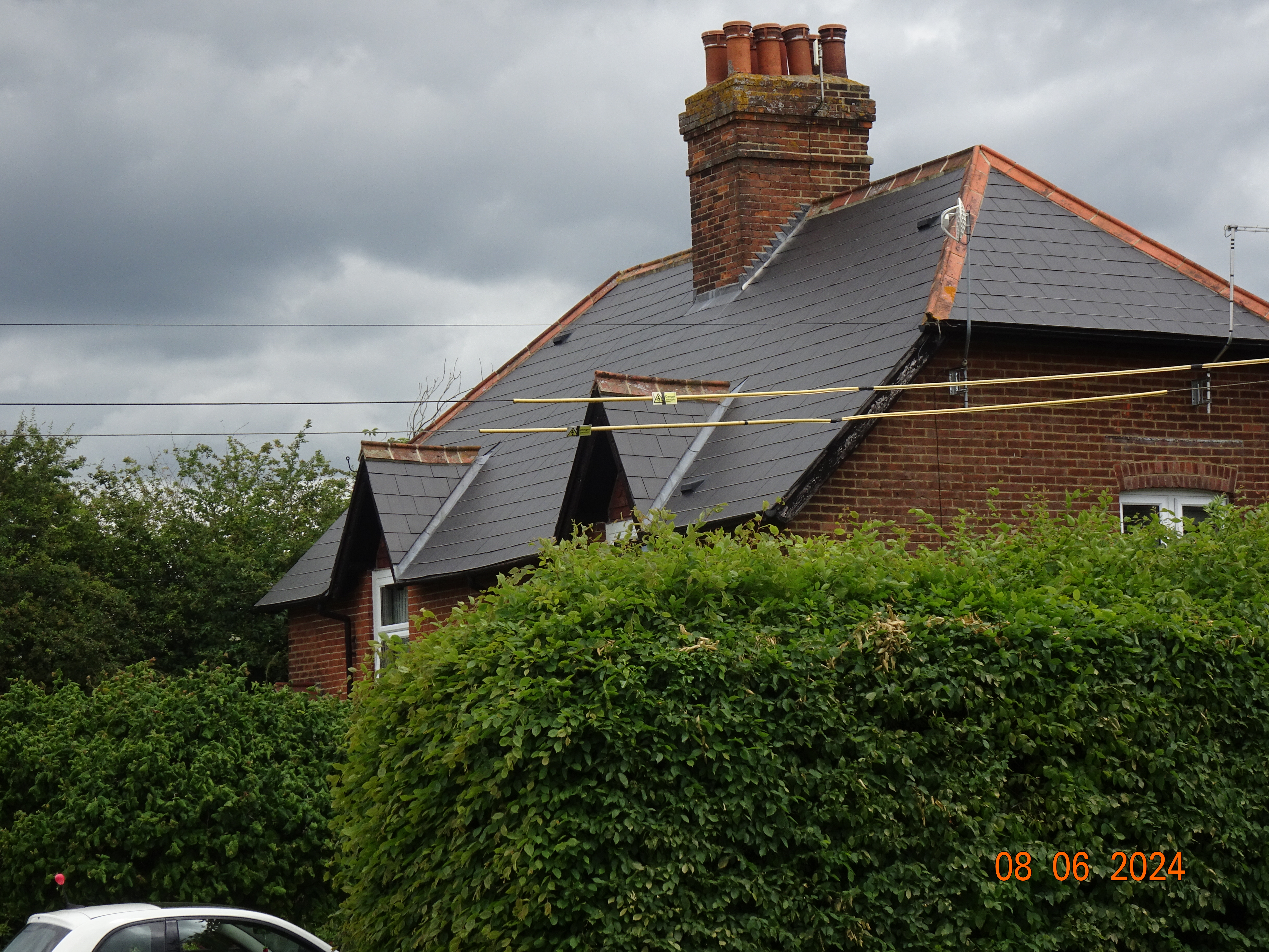


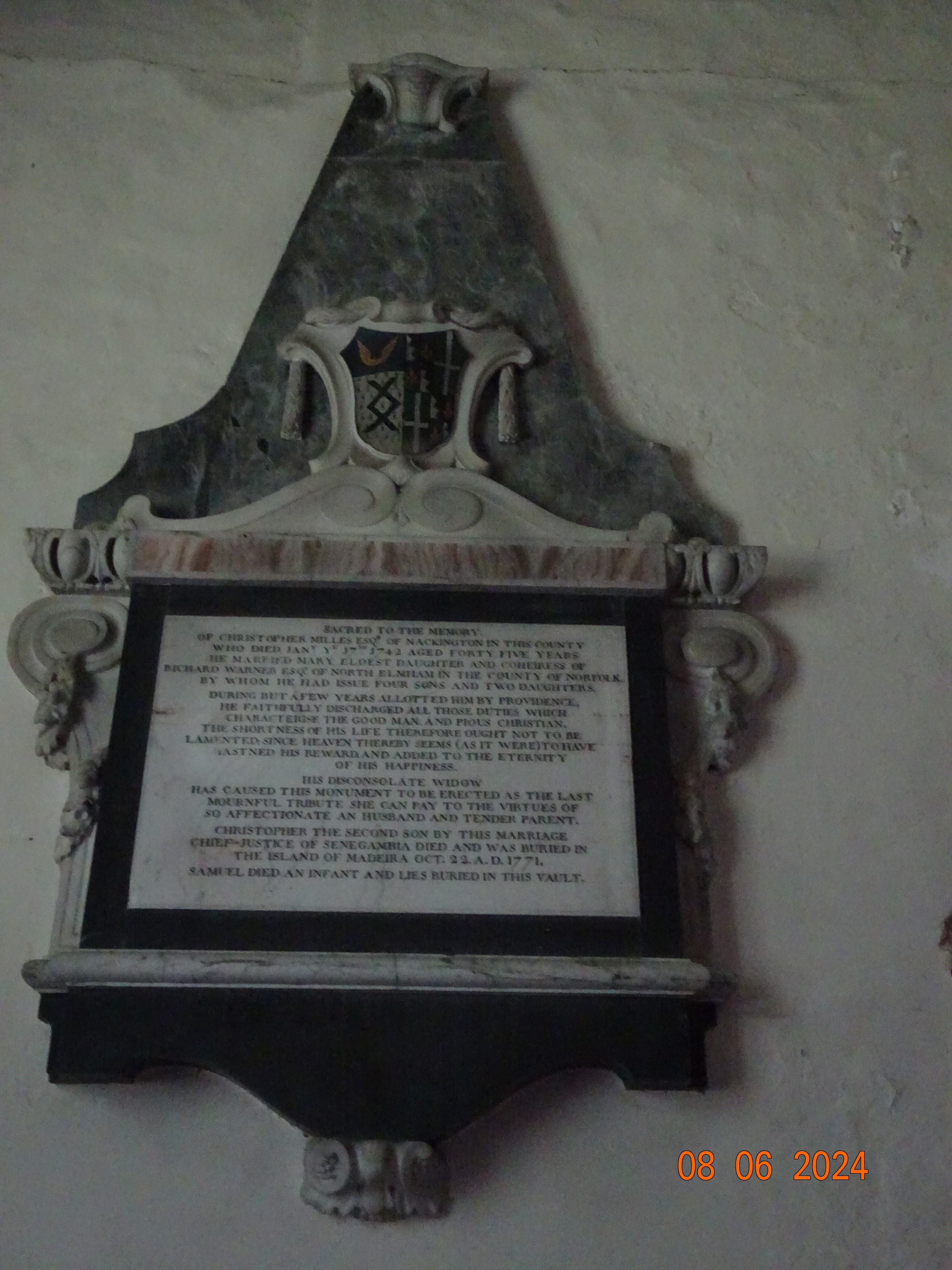

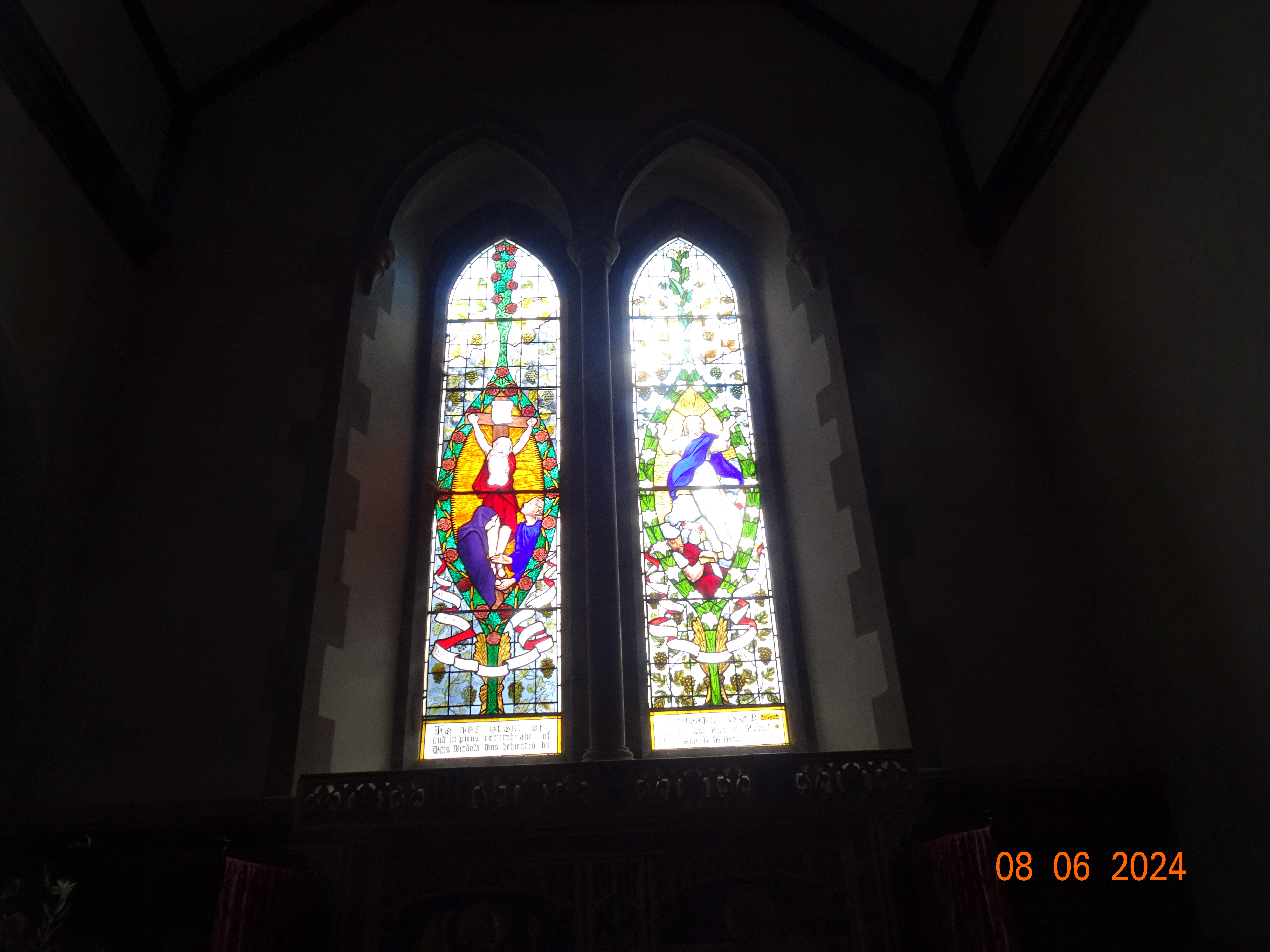


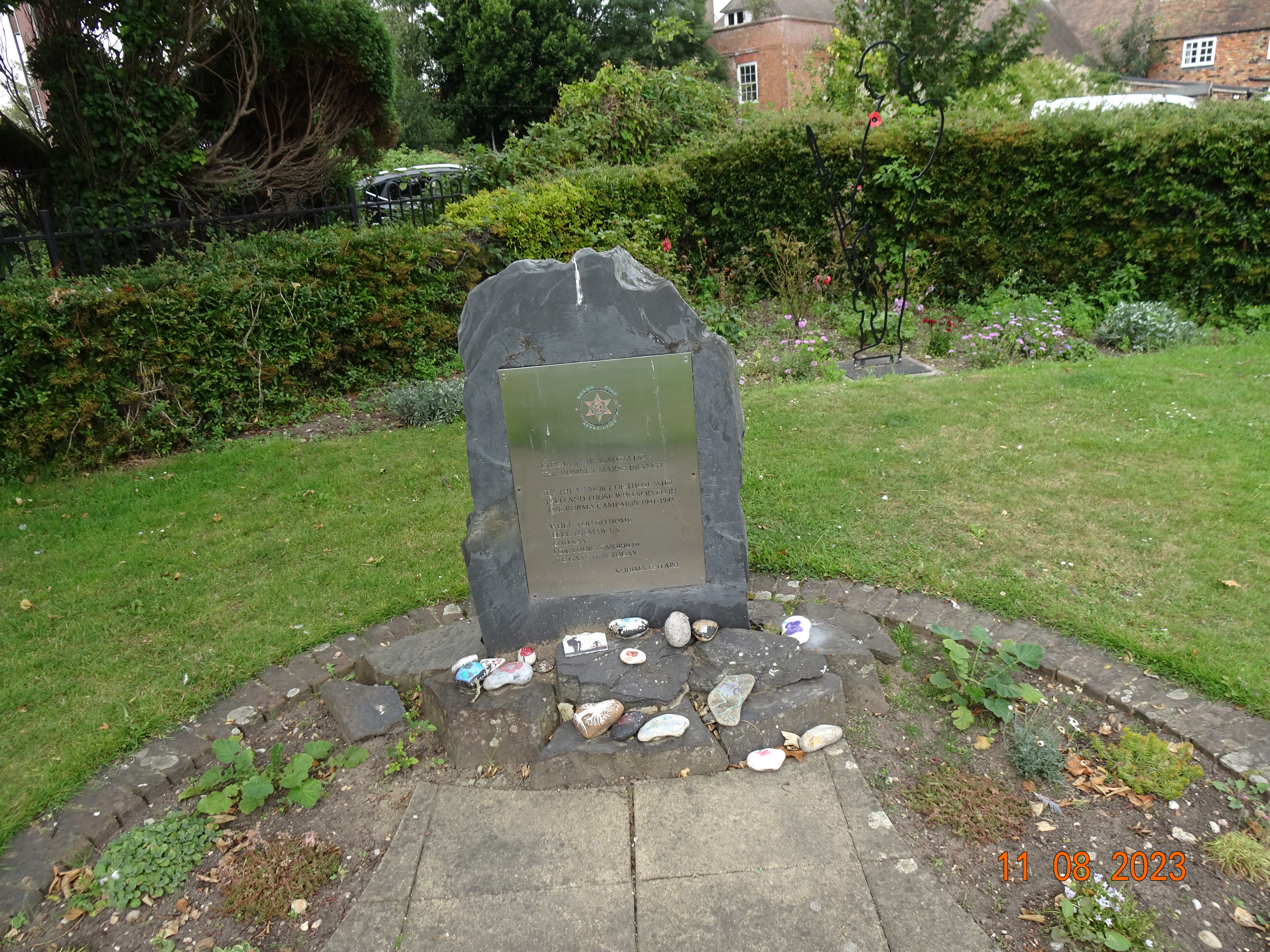


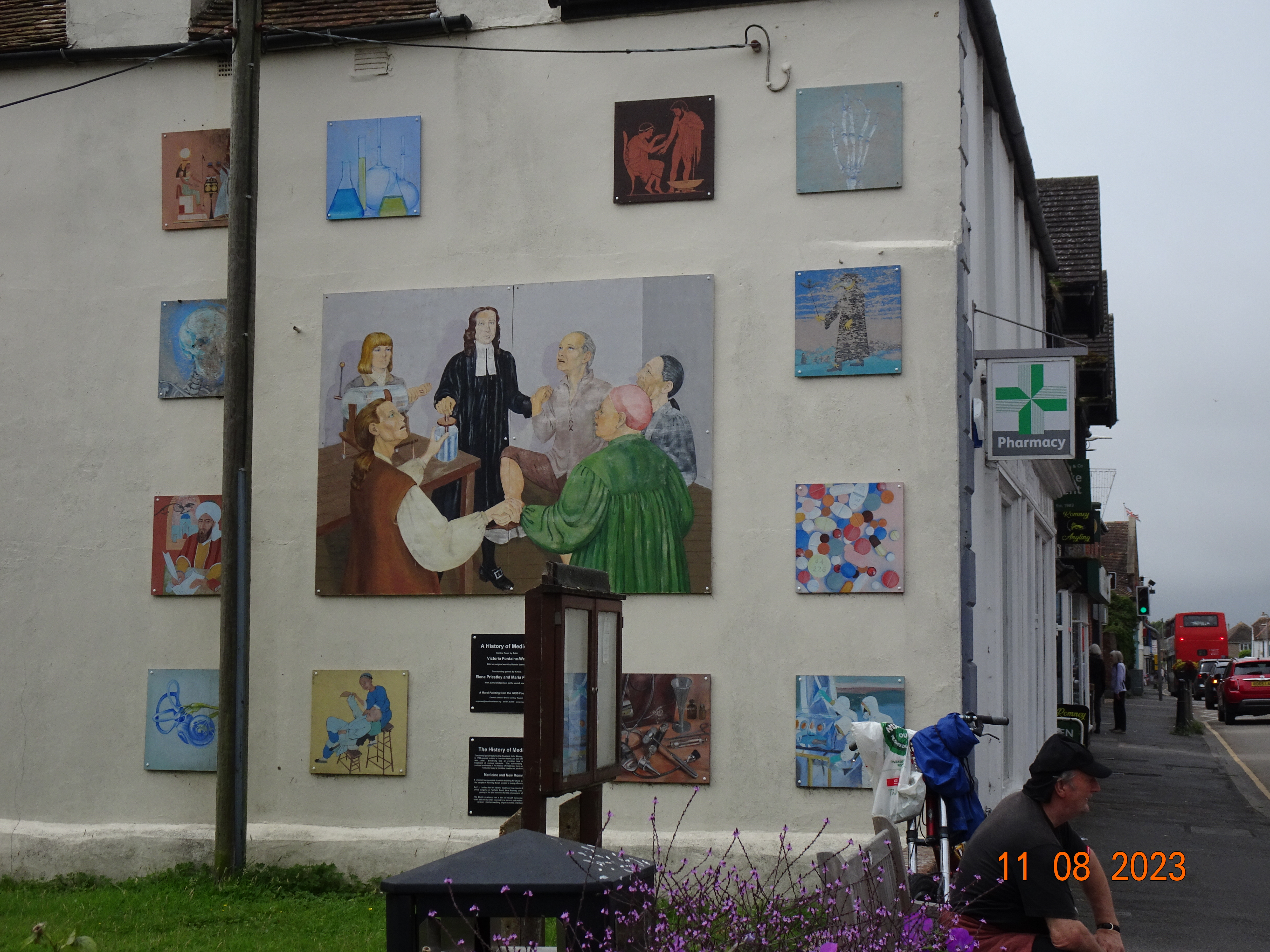


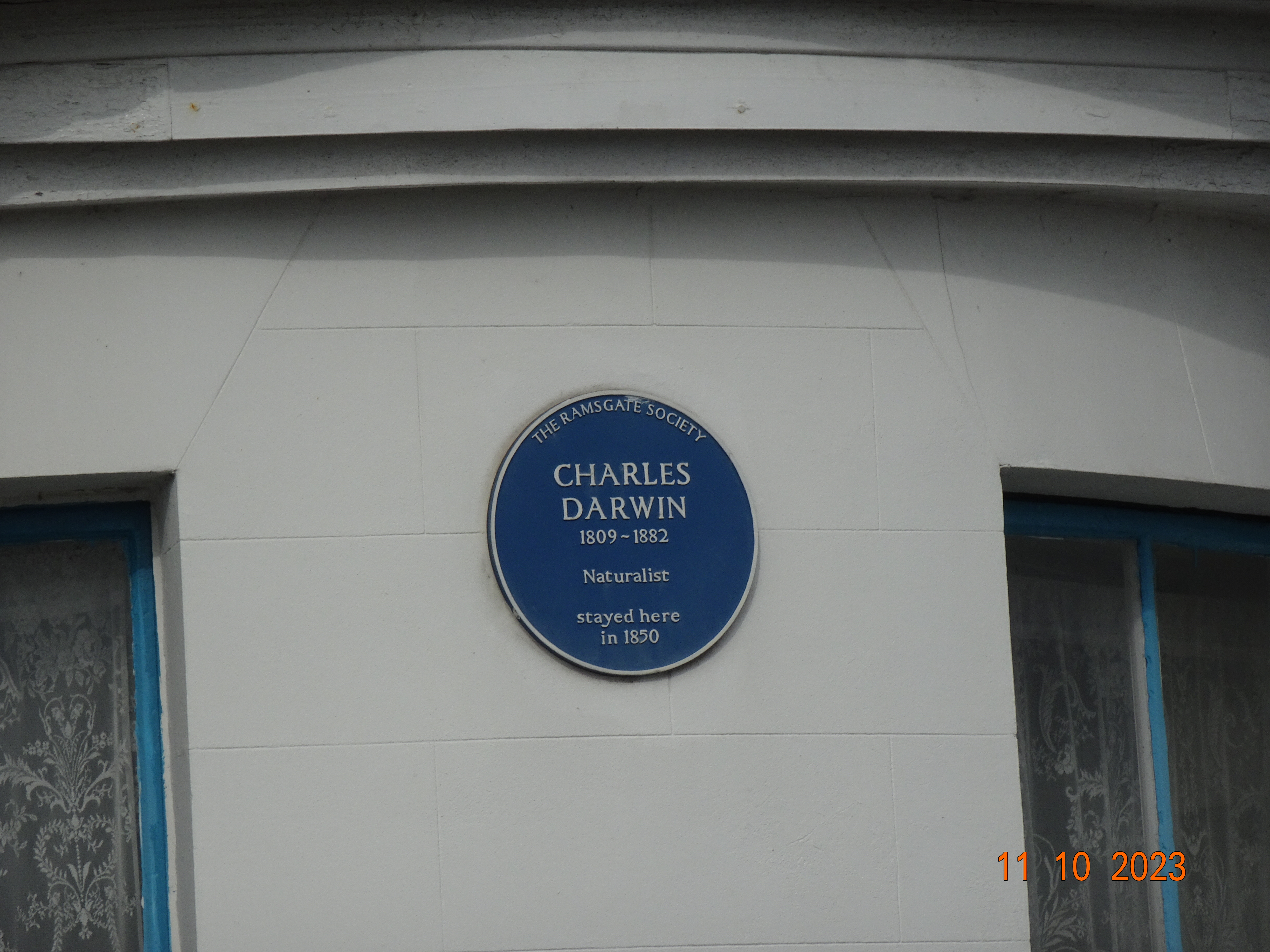


No comments:
Post a Comment